
Sea Kayaking in Ireland: A Complete Guide
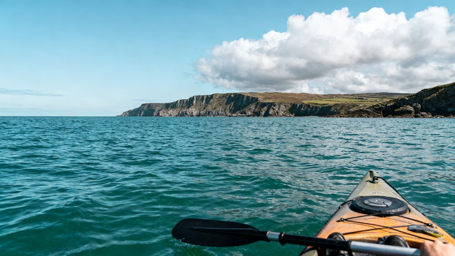
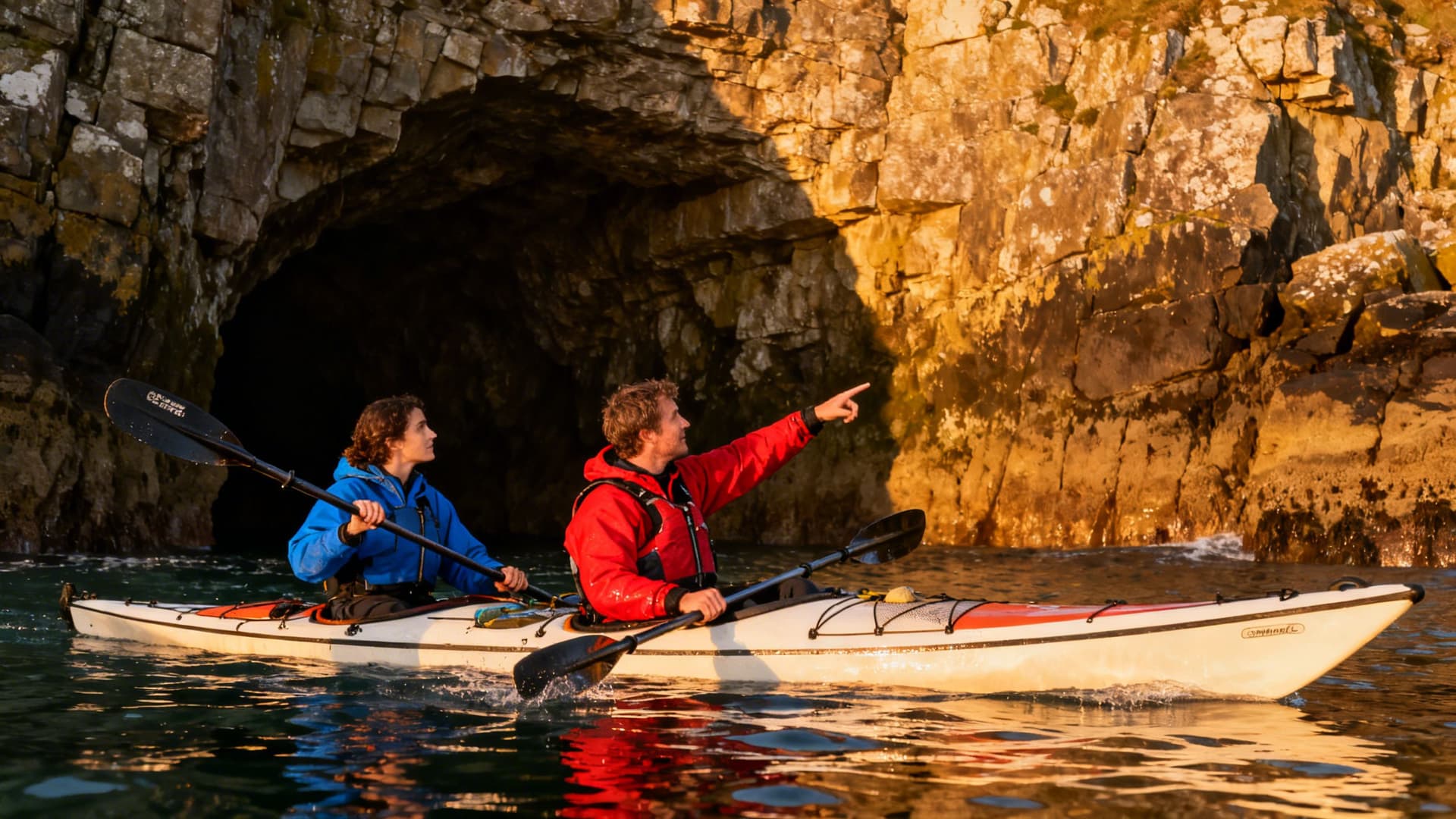
You are somewhere on the west coast and the world has gone quiet. Not the quiet of a field or a forest — something more specific. The slipway is two kilometres behind you. The road that follows the coast above is invisible from this angle. What you can see, sitting in the water at sea level, is cliffs you’ve never been close enough to read. A seal on a rock that hasn’t moved. And ahead of you, the shape of an island that doesn’t have a ferry service and won’t be visited today by anyone other than you.
Sea kayaking on the Irish Atlantic coast is not a single thing. It is a first session on a sheltered bay in Connemara, with a guide talking you through a wet exit before you’ve gone anywhere. It is a fifteen-kilometre open-water crossing to the Aran Islands in flat June conditions. It is a five-day circuit through the islands off Donegal, camping from the kayak, with a weather window that gave you three days of flat water and two days watching the horizon. It is paddling past the Cliffs of Moher from below, which is the one perspective of those cliffs that the million annual visitors on the path above will never have.
This guide covers the full scope of what sea kayaking in Ireland involves — the regions, the seasonal logic, the experience required, the crossings, the multi-day options, and what separates a session that’s merely safe from one that’s genuinely extraordinary.
The Irish Atlantic Coast: What You’re Actually Paddling
The Irish coast has over 2,500 kilometres of shoreline, and the majority of that facing west and northwest opens directly onto the Atlantic without the buffer of a continental shelf to attenuate the swell. That matters. This is not a Mediterranean coast or a sheltered sea. It is an ocean coast, and the difference shapes everything about how sea kayaking works here — the equipment, the seasons, the decision to go and the decision not to.
What it also means is a coastline of extraordinary variety within relatively short distances. The same county can have a sheltered estuary with kilometres of protected flatwater and, twenty minutes’ drive along the same shore, an exposed headland where the full Atlantic swell wraps around sea stacks that stand in water nobody paddles alone. The skill of sea kayaking in Ireland is partly knowing how to read which stretch of coast you are on.
Four things define the experience: the swell state, which is generated by low-pressure systems tracking east across the North Atlantic and bears no fixed relationship to the local wind; the tidal range and current, which on the west coast runs significantly and accelerates around headlands in ways that can turn a straightforward route into a committed one; the light, which at this latitude has a quality in late spring and early autumn that photographers spend careers trying to reproduce; and the water temperature, which ranges from around 8°C in February to 16°C in August and governs what you wear, which governs how long you can safely be in the water if you end up in it.
Understanding these four variables, for a specific stretch of coast, on a specific day, is what separates the paddlers who know this coast from those who are encountering it for the first time. It is also why the guide relationship on the Irish Atlantic coast is not incidental.
Where to Sea Kayak in Ireland: The Major Regions
Ireland’s sea kayaking is concentrated on the west and northwest coast, from Kerry in the southwest up through Clare, Galway, Mayo, and Donegal in the north. Each region has a distinctive character.
Connemara is the most complete single sea kayaking landscape in Ireland. The combination of offshore islands, protected bays, tidal channels, and the Twelve Bens as a constant backdrop produces a coast that works for first-timers in the sheltered inner channels and for experienced paddlers heading out toward the Aran fringe. Sea Kayaking in Connemara: The Twelve Bens, the Islands, and the Atlantic from a Kayak covers the specific sections and what distinguishes paddling here from anywhere else on the coast.
Kerry produces the most dramatic sea kayaking on the south coast. The Iveragh Peninsula — the Ring of Kerry from the water — has sections of cliff that are unreachable from above and coves that appear on no road map. Skellig Michael is visible twenty kilometres to the southwest on a clear morning from St Finian’s Bay, and the approach to the Little Skellig colony is one of the most remarkable wildlife experiences you can have from a kayak anywhere in Europe. Sea Kayaking in Kerry: The Ring of Kerry from the Water covers the Iveragh coast and the Skellig approach in full. The Dingle Peninsula, the other arm of Kerry, offers different water again — a more intimate coastline, the Blasket approach, and the sea caves on the north Dingle coast that require a specific combination of conditions and local knowledge. Sea Kayaking Along the Dingle Peninsula: Paddling the End of the World covers it in detail.
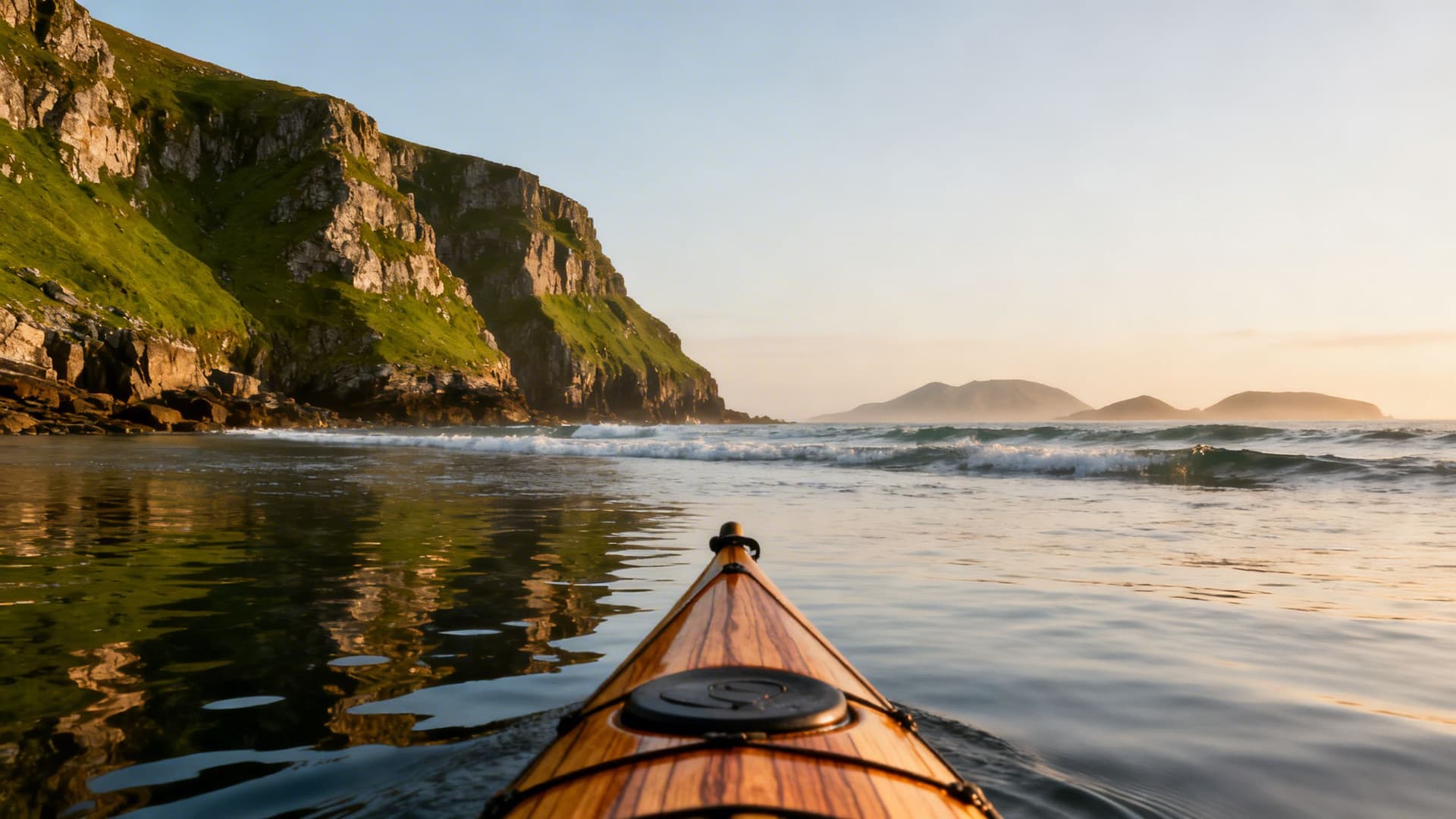
The Cliffs of Moher from the water. The path on top has had a million visitors. The water below the cliffs, where the cliff face rises vertically above you and the caves and sea stacks are visible at their actual scale, is a different experience and a different perspective entirely. The open-water approach from the launch point below the cliffs requires genuine sea kayaking competence — this is not sheltered water. Sea Kayaking at the Cliffs of Moher: A Paddler’s Perspective covers the logistics, the conditions window, and what you find when you are underneath what you have previously only looked down at.
Donegal is the wild end. The sea stacks at Slieve League — the highest marine cliffs in Europe — are paddleable in a way that combines vertical scale and Atlantic exposure in a proportion you don’t find on any other section of the Irish coast. The Inishowen Peninsula on the northern tip faces Scotland across a stretch of water that feels it. The islands off the south Donegal coast are accessible multi-day territory for paddlers who have already done a simpler circuit and are ready for the next category. Sea Kayaking in Donegal: Sea Stacks, Hidden Coves, and the Wild Northwest covers the region in full.
Sea Kayaking for Beginners: How the Skill Actually Builds
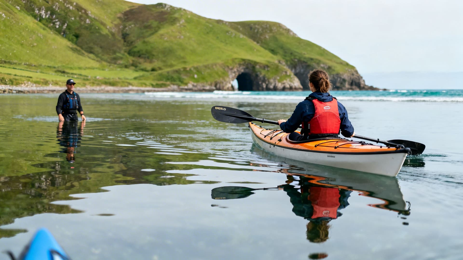
Most people who take a first sea kayaking session on the Irish coast have no idea how quickly the skill develops. The first session — on a sheltered bay, in calm conditions, with a guide — covers the paddle technique, the wet exit (getting out of the kayak underwater if it capsizes, which is less alarming than it sounds once you’ve done it twice), and the basics of edging and turning. By the end of a two-to-three hour session, most people are comfortable enough on the water to recognise that they want to come back.

What develops after that first session is a read of the water rather than a mechanical skill. You get used to reading the surface — the difference between wind ripple and swell, between a smooth patch that means depth and a dark patch that means current. You learn to sit into the kayak rather than on top of it, to use your torso and not just your arms, to let the boat move with the water rather than against it. These things take a few sessions and then they are simply how you paddle.
The journey from a first sheltered bay session to a guided island crossing typically takes a handful of sessions spread across a year or two — or, for people who come back repeatedly on a guided Atlantic trip, can compress significantly faster. There is no single progression route. There is the progression that fits where you are.
Sea Kayaking for Beginners in Ireland: What Your First Session Will Actually Feel Like covers the first session in detail — from getting into the kayak at the slipway, to the moment an hour in when you’ve stopped thinking about the paddle and started thinking about where you’re going.
Paddling to Ireland’s Islands: What the Crossings Involve
Ireland has over three hundred islands. More than a hundred are within paddling range of the west and northwest coast. The islands that are hardest to reach are, consistently, the ones most worth reaching. The connection is not coincidental.
The crossings divide into three broad categories. Sheltered short crossings — under three kilometres with natural wind shadow — are achievable for paddlers with guided experience. Moderate open crossings — four to six kilometres over open water where swell and tide need reading — are appropriate for paddlers who have accumulated some sessions in varied conditions. Serious offshore crossings — Inishmurray off Sligo, the full Aran crossing from Connemara, the Inis Bofin approach in a northwesterly — require genuine offshore sea kayaking competence and a guide who has run that specific passage across multiple seasons.
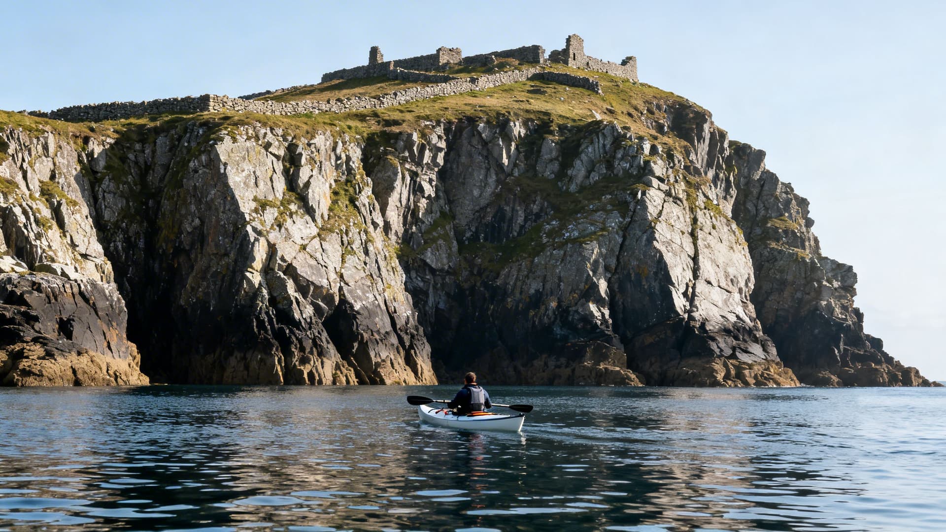
Inishmurray, seven kilometres off the Sligo coast, holds one of the best-preserved early Christian monastic complexes in Ireland. The cashel walls stand to head height. There are oratories, beehive cells, and cursing stones that the island tradition says you don’t reposition. The island has been uninhabited since 1948. You are the only boat there. The ferry doesn’t come here because there is no ferry.
The Aran Islands from the water are a different proposition from the Aran Islands arrived at by ferry or plane. The fifteen-kilometre open-water approach from Rossaveal on the Connemara coast, with Inis Mór growing from a line on the horizon to a wall of limestone terracing, gives you the islands in a way that a tourist board photograph cannot.
Inis Bofin, the most accessible serious crossing on the Connemara circuit and the standard first overnight island for multi-day paddlers in the region. Eight kilometres from Cleggan, with a sheltered Bronze Age harbour on its eastern side and a fourteenth-century fort at the harbour entrance.
Sea Kayaking to Ireland’s Islands: Inishmurray, the Arans, Inis Bofin, and the Crossings in Between covers each crossing’s requirements, what the tidal geometry looks like mid-passage, and what each island contains that isn’t in any publicly available source.
Multi-Day Sea Kayaking: The West Coast from the Water
The multi-day sea kayaking trip is a different category of experience from a day session, beginning with how you think about weather. On a day trip, a bad forecast means you reschedule. On a multi-day trip, a bad forecast means you are on a beach with two days of food, reading the horizon for signs that tomorrow might move. That shift in your relationship with the weather is not a problem. For most paddlers who have experienced it, it turns out to be the point.
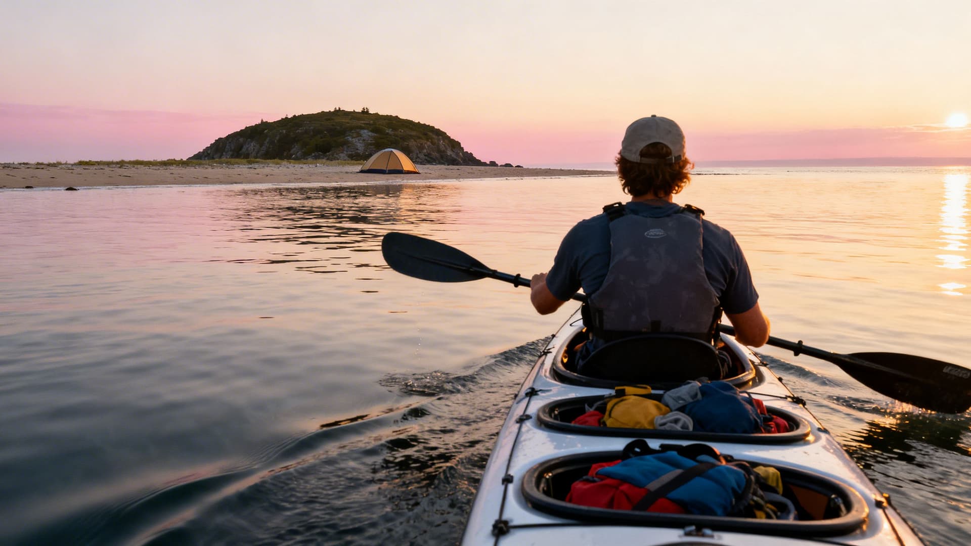
Everything in a sea kayak hatch on a multi-day trip: tent, sleeping bag, food, water, dry clothes, medical kit. The kayak handles differently loaded, and the difference between a well-balanced hull and an unbalanced one is measurable in both effort and safety on an exposed coast. The daily distance target — typically fifteen to twenty kilometres — is less about physical capacity on any single day and more about what your body is doing by day three when the muscles are already worked and the sleep hasn’t been perfect.
The Connemara island-hopping circuit is the most accessible first multi-day route — the Twelve Bens as a constant backdrop, the inner islands reachable without long open-water crossings, achievable for paddlers with some guided sea kayaking experience behind them.
The Beara Peninsula in Cork-Kerry offers a more sheltered circuit by Irish standards, with Bear Island, the Kenmare River estuary, and Dursey Sound — the tidal stretch between the peninsula’s tip and Dursey Island — which has a reputation among sea kayakers that is entirely earned.
The Inishowen coastal route in Donegal is the demanding end: sea caves, seal colonies, cliffs with no road access, and swell exposure on the north Donegal coast that is not for paddlers completing their first overnight trip.
Multi-Day Sea Kayaking in Ireland: How to Plan a Paddle Camping Trip on the West Coast covers the circuits in detail, the camping logistics (including the legal realities of wild camping in Ireland), reading a five-day Atlantic forecast for a specific stretch of coast, and what a guide changes on a trip of this kind.
When to Come: The Seasonal Logic of the Atlantic
There is no simple good season or bad season on the Irish Atlantic coast. What there is is a pattern — one that, once you understand it, tells you not just when to come but how to think about specific ambitions.
Atlantic swell is generated by low-pressure systems tracking east from North America. These systems are most powerful between October and March, which makes winter a specialist’s activity. Summer — June through August — sees smaller average swell and more settled weather, with the important qualification that “average” is doing significant work on a coast that can push two-metre groundswell in July without much notice.
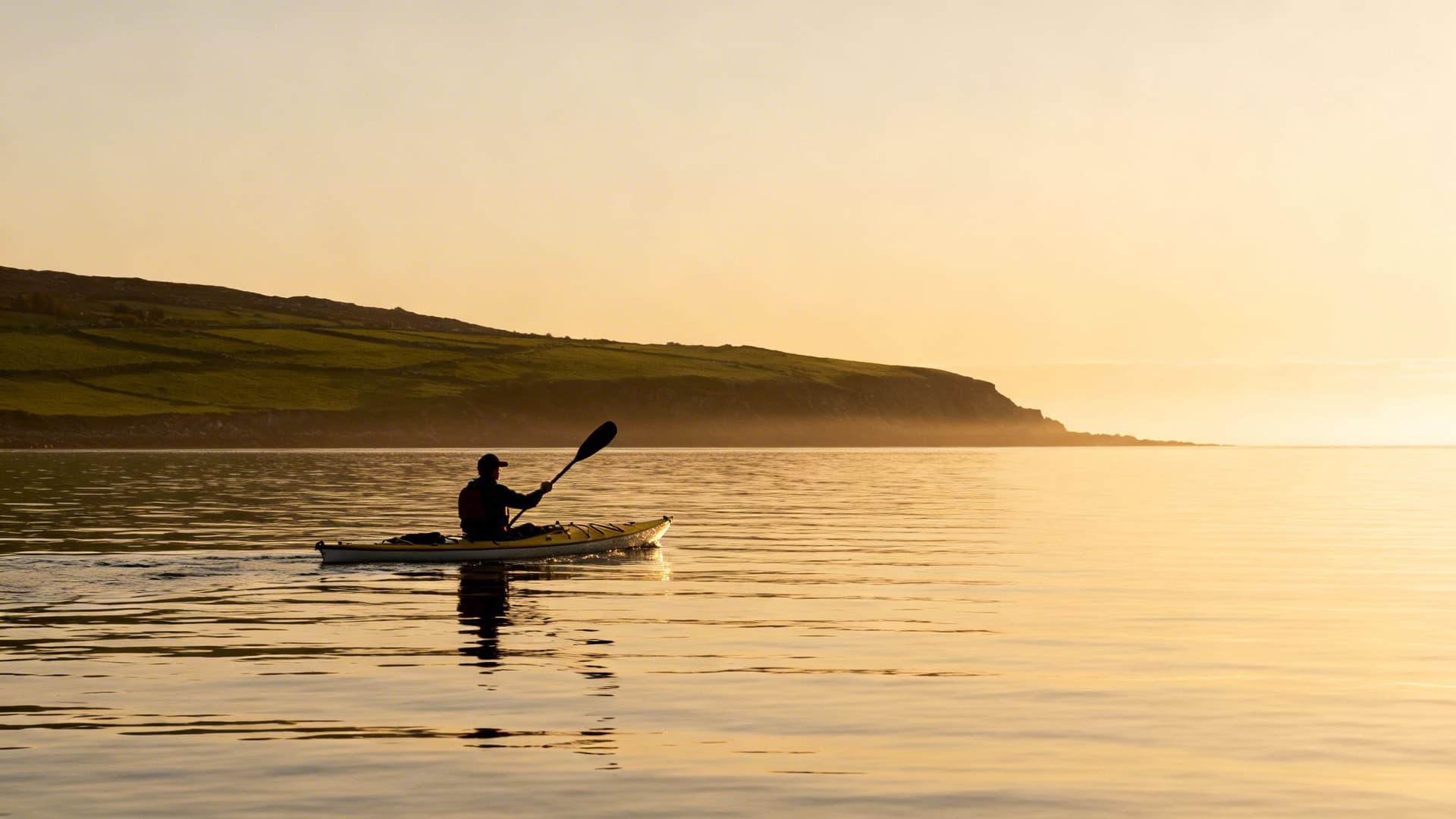
May and September are the insiders’ months. Ask any guide who has been paddling the west coast for a decade which months they prefer. The answer is nearly always one of these two. May offers seventeen hours of light by its third week, Atlantic swell patterns loosening from winter, and a west coast that the tourist coaches haven’t yet reached. September holds the same advantages from the other direction — the summer ferry traffic has ended, the campsites are emptying, and the light in late September on the Kerry coast has a quality of angle and warmth of tone that summer light simply doesn’t have.
June and early July are the most reliable window for island crossings specifically — swell at its summer minimum, visibility good, midsummer light extending to nearly ten-thirty in the evening on the west coast.
Winter paddling is its own category. Not tourism. A specific relationship with the coast in its winter state, requiring cold-water drysuits, significant offshore experience, and a guide who has been reading these specific waters in winter for years. For those paddlers, on the right January morning when the swell has briefly laid down between systems, the coast is something that summer paddlers with their crowded slipways will never see.
When to Sea Kayak in Ireland: A Month-by-Month Guide to Conditions, Light, and the Atlantic Swell covers the full seasonal picture, including the specific implications of each month for island crossings, multi-day trips, and what the Irish Atlantic looks like from a kayak in December.
What to Pack and What You’ll Wear
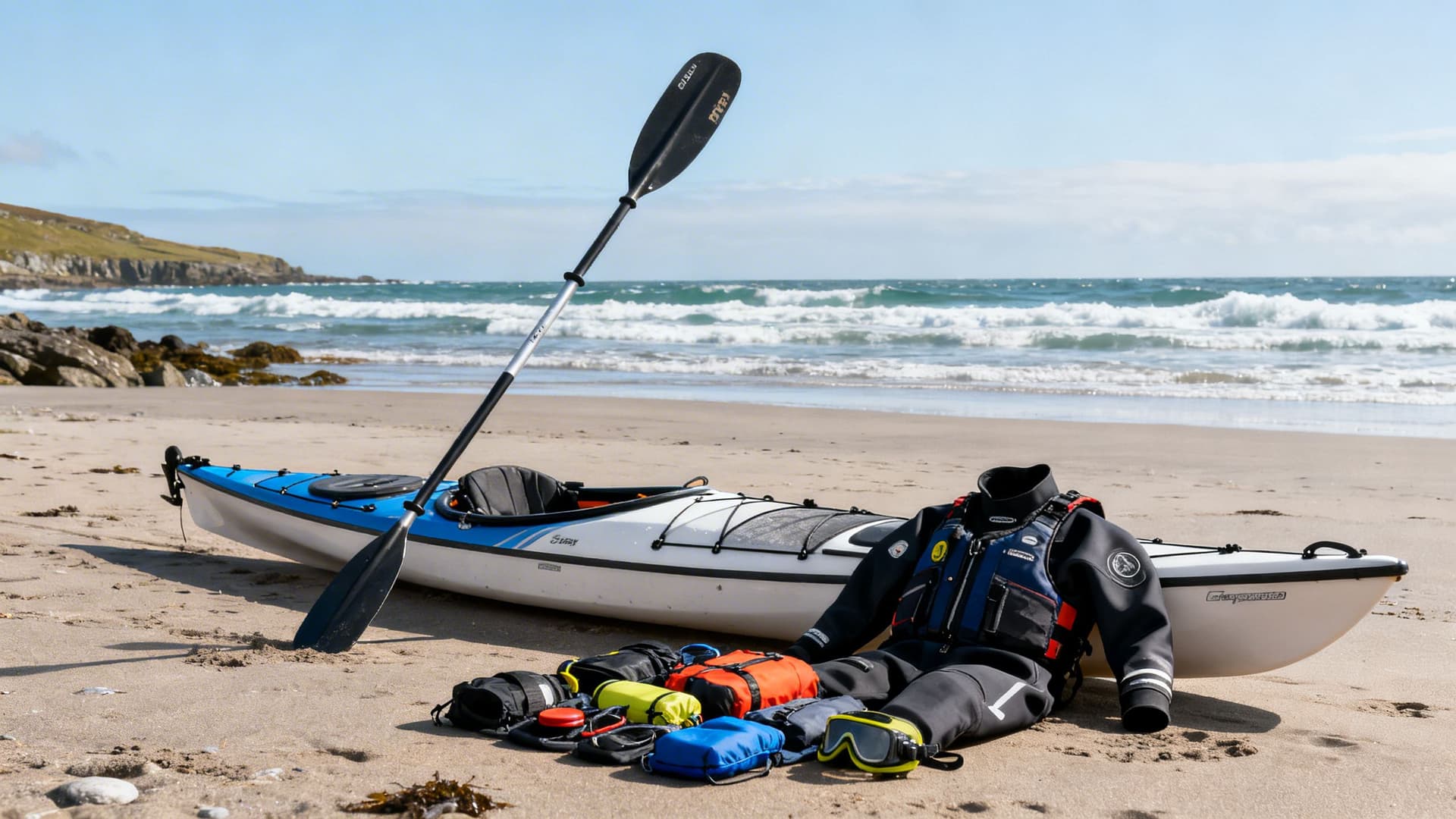
Most guided sessions on the Irish coast supply everything you need — kayak, paddle, buoyancy aid, and the appropriate thermal protection for the season. What varies by season is the thermal protection itself, and understanding the logic behind it helps you understand what kind of paddling you’ve signed up for.
Irish Atlantic water temperatures range from approximately 8°C in February to 16°C in August. A wetsuit — typically a 5mm steamer — is appropriate for day sessions from May through September. A drysuit is standard for everything outside those months and is recommended year-round for multi-day trips, where immersion risk accumulates over multiple crossings and the consequences of an unplanned swim are more serious.
The calculation is simple: what are you wearing if you end up in the water, and how long can you function until you’re back in the kayak or on shore? On a sheltered summer bay, a wetsuit and a guide nearby answers that question adequately. On a seven-kilometre offshore crossing in May, a drysuit answers it better.
For multi-day trips and island crossings, what you carry in the kayak becomes a separate question — camping gear, navigation tools, emergency kit, food and water management. The weight balance matters as much as the list.
What to Pack for Sea Kayaking in Ireland: A Practical Kit Guide covers the complete kit picture — what to bring regardless of season, what changes by month, what guides typically supply versus what you need to source, and the packing geometry that keeps a loaded sea kayak handling properly.
Why the Guide Is the Product
There is a version of this conversation where a guide is described as a safety measure. That version misses the point.
A sea kayaking guide on the Irish Atlantic coast is not a safety backup. They are the mechanism through which the experience becomes what it is. The coves on the Iveragh Peninsula that don’t appear on road maps don’t appear on road maps because there is no road to them. The approach to a seal colony works because a guide knows the angle and the speed that keeps the seals curious rather than alarmed. The island crossing happens on a Tuesday morning rather than a Wednesday because someone has been reading that specific channel for ten years and knows which morning the swell will lay down.
What guides carry that no app or chart provides: the cumulative seasonal knowledge of how a specific stretch of coast behaves in specific conditions. The cloud formation over the Twelve Bens that means the window is closing. The tidal stream through the Aran passage that sets you south and the correction angle that gets you to the right beach. The landowner’s gate that is the only vehicle access to a launch point on a stretch of coast with no public slipway.

On a multi-day trip, the guide role expands further — into expedition logistics, contingency planning, landowner relationships along the camping route, freshwater source reliability in drought years, and the accumulated institutional knowledge of how to run a circuit when the week doesn’t go as planned.
The planning conversation with a guide in the weeks before you arrive is part of what you are buying. Circuit options, experience level assessment, realistic weather expectations, contingency routes. A reputable guide will tell you if the trip you’ve described isn’t realistic for the experience you have, and will tell you what is. That honesty is also the product.
Ireland’s sea kayaking guides are typically people who have paddled the same water for most of their careers. Their knowledge is embedded in the specific geography they’ve spent years on, not transferable from a map. When you book with a guide who has run the Connemara circuit every May for fifteen years, you are booking those fifteen May mornings as much as the one you’ll be on.
Frequently Asked Questions
Is sea kayaking in Ireland suitable for complete beginners?
Yes — with a guide, on the right stretch of water, in the right conditions. The first session on a sheltered bay is accessible to anyone with reasonable physical fitness. Most beginners find the kayak more stable and the paddle technique more intuitive than expected. What you are not doing as a beginner is open-water crossings or exposed headland routes — those require accumulated experience. Sea Kayaking for Beginners in Ireland: What Your First Session Will Actually Feel Like covers exactly what to expect.
What is the best time of year to sea kayak in Ireland?
May and September offer the best overall combination — manageable Atlantic swell, minimal tourist traffic, extended daylight, and the particular quality of light on the Irish coast that experienced paddlers return for. June and early July are the most reliable window for island crossings specifically. August is the warmest water temperature but the busiest coast. When to Sea Kayak in Ireland: A Month-by-Month Guide covers the seasonal logic in full.
Do I need to bring my own equipment?
No — guided sessions on the Irish coast supply kayak, paddle, buoyancy aid, and appropriate thermal protection. For multi-day trips, your guide will specify what personal items to bring and what will be supplied. If you are paddling independently, What to Pack for Sea Kayaking in Ireland covers the full kit picture, including the drysuit question and the packing geometry for multi-day hatches.
How physically fit do you need to be?
A typical guided day session — three to five hours of paddling — requires a moderate baseline fitness. The technical demands are lower than most people assume; sea kayaking uses the torso and core more than the arms, and the stroke becomes efficient quickly once a guide has shown you the mechanics. Multi-day trips require more sustained capacity and the ability to manage cumulative fatigue across days; most guides will have a realistic conversation about this in the planning phase.
Can I paddle independently on the Irish coast, or do I need a guide?
Experienced sea kayakers with a track record in tidal Atlantic water paddle independently on the Irish coast regularly. For any exposed section — open crossings, headlands, winter conditions — that experience needs to be genuine, not assumed. For paddlers who are newer to sea kayaking or who are unfamiliar with a specific section of the coast, a guide is not a restriction on the experience. It is what makes the better parts of the experience achievable.
How long does a typical island crossing take?
It depends on the crossing and the conditions. The Inis Bofin crossing from Cleggan takes approximately ninety minutes to two hours in normal summer conditions. The full Aran crossing from Rossaveal is a four-to-five hour committed paddle. The Inishmurray crossing from Mullaghmore runs about ninety minutes to two hours one way. All of these timings assume manageable conditions; a guide who knows the crossing will adjust the plan — or the day — if the conditions are different from the forecast.
The Full Picture
The Irish Atlantic coast from a kayak is not a single experience with a single season and a single entry point. It is a full range — from a first afternoon on a sheltered bay in Connemara to a five-day circuit camping on uninhabited islands to a winter morning in Kerry when the swell has laid down and the January light is on the water in a way that photographers spend careers trying to replicate from the cliff path above.
Sea Kayaking in Connemara and Sea Kayaking in Donegal cover the north and northwest coast’s full paddling range. Sea Kayaking in Kerry and Sea Kayaking Along the Dingle Peninsula cover the south. Sea Kayaking at the Cliffs of Moher is the Clare coast. Sea Kayaking to Ireland’s Islands covers the crossings. Multi-Day Sea Kayaking in Ireland covers what it means to actually live on this coast from a kayak. When to Sea Kayak in Ireland covers when to come. What to Pack covers what to bring. And Sea Kayaking for Beginners in Ireland covers where to start if you haven’t started yet.
The coast is here. The guides who know it are here. The window opens in May.
Table of Contents
Share this post
More from the Blog

Bog Bodies of Ireland: Where Ancient Remains Meet the Bog
Ireland's bog bodies are among the best-preserved prehistoric remains in Europe. Here's where they were found, what they reveal, and how to see them with a local guide.

Bog Oak Ireland: The Ancient Wood Preserved in Peat
Bog oak is ancient oak wood preserved in Irish peat bogs for thousands of years. Learn how it forms, where to see it, and why Irish craftspeople still value it today.

Ireland's Bogs & Peatlands: A Complete Guide to the Landscape, History and Wildlife
Ireland's bogs and peatlands shaped its culture, climate, and wildlife. Discover raised bogs, blanket bogs, fens, turf-cutting heritage, bog bodies, and where to explore with a local guide.