
Sea Kayaking in Donegal: Into the Coastline That Has No Equivalent
Sea Kayaking in Donegal: Into the Coastline That Has No Equivalent
The road to Malin Beg runs out at a car park above a silver beach. You can see the beach and you can see a strip of the cliff behind it. What you cannot see — what the road was never designed to show you — is the coastline that continues northwest from there for another sixty kilometres, folding into headlands and caves and sea stacks and the broken face of Slieve League, with almost no point of access from land. Donegal's coastline is one of the most dramatic stretches of the Irish Atlantic coast. Most of it, for most of the people who come to see it, remains invisible.
From a kayak, it opens. Sea Kayaking in Ireland: A Complete Guide maps the full breadth of what Ireland's west coast offers from the water. This article is about the stretch of it that has no equivalent elsewhere in Ireland — a Donegal coastline that you have to earn with a paddle and a guide who has spent years learning which days the swell permits passage and which it doesn't.
The Donegal Coast: A Geometry That Doesn't Work from Land
Donegal's northwest coastline runs from Killybegs in the south to Malin Head at the country's northern tip — roughly 180 kilometres of Atlantic-facing shore that includes cliffs, offshore islands, sea stacks, caves, and beaches accessible only from the water. The county's geography works against the road. Headlands push out into the sea at angles that roads can't follow. Deep inlets require long detours inland. Much of the coast that appears on a map as a simple line is, in practice, a broken architecture of rock faces and cave entrances that face southwest into the Atlantic and reveal themselves fully only from sea level.
This is not a case of scenery being better from the water. It is a case of scenery that doesn't exist from anywhere else. The cave systems at Maghera, the full profile of Slieve League, the sea stacks off the Glencolumbkille coast — none of these are properly visible from the land at all. The water is not an alternative viewpoint. It is the only one.
Slieve League from the Water: The Full Picture
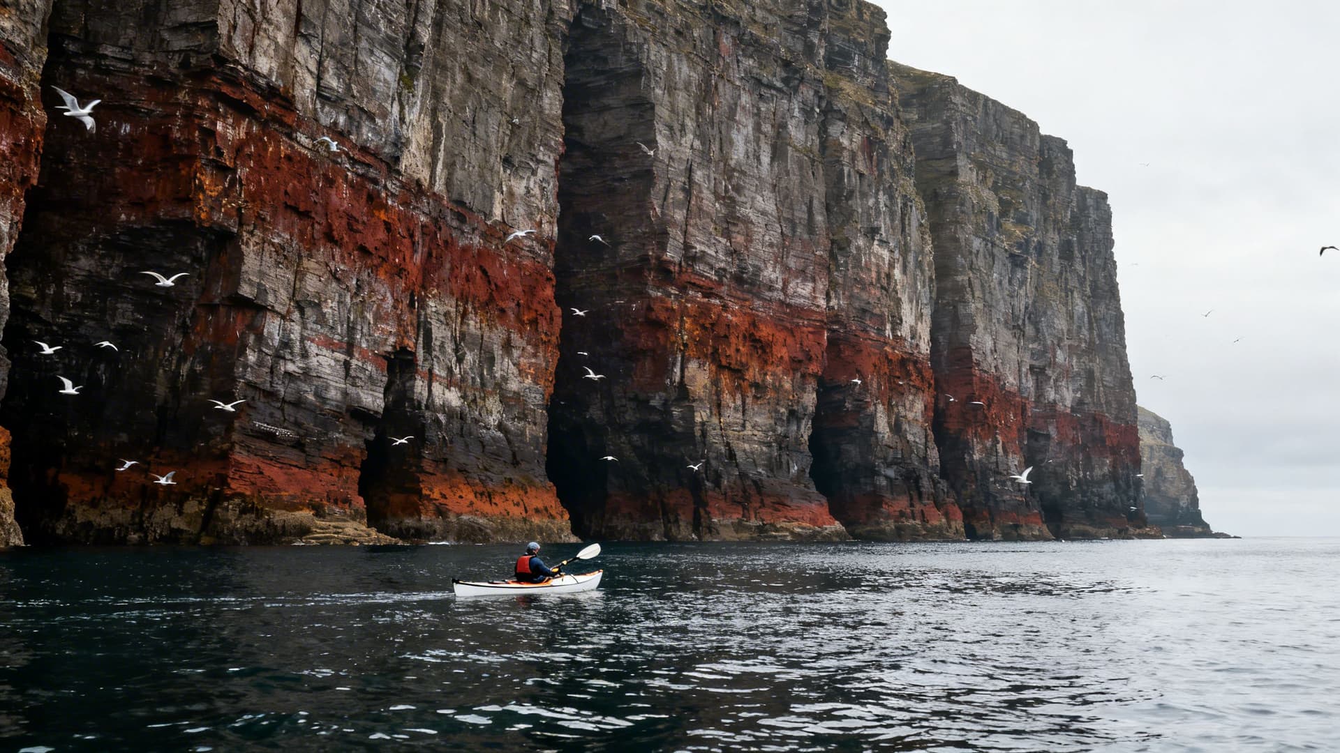

Slieve League's sea cliffs are among the highest in Europe at 601 metres — nearly three times the height of the Cliffs of Moher, and less than a tenth as visited. There is a cliff-top path that brings walkers to the ridge, and from there the drop is substantial and the view west is long. But what the cliff path shows you is height. It does not show you the cliff itself.
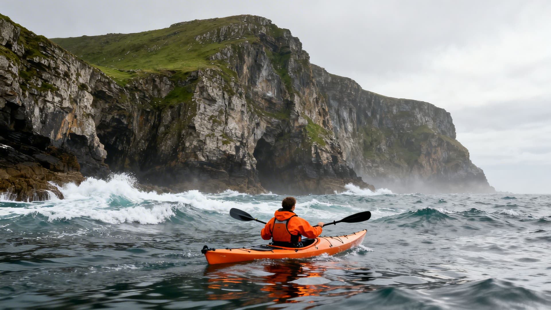
From a kayak at the base of Slieve League, the geometry reverses. The cliff face starts at the waterline, fractured and coloured in reds and greens from ancient iron deposits and lichen, and it rises 601 metres straight up until the ridge disappears into whatever the sky is doing that day. You cannot take it in in a single view. Your eye moves section by section — the tide-marked rock at the waterline, the fault lines that run vertically through the face, the ledges where fulmars and kittiwakes have established nesting sites for centuries. The scale is not aesthetic from here. It is physical. You feel it in your chest.
The paddle along the cliff base takes longer than it looks on a map. The cliff is not a single face — it steps and breaks and extends into the water in buttresses that must be rounded, each one revealing a new section of rock. On a clear day with a low swell, the reflection of the cliff in the water below doubles the visual mass of the whole thing. On a grey morning with light cloud and a slight chop, the rock takes on a colour that sits somewhere between charcoal and green and doesn't appear in any photograph of this coast.
The Caves at Maghera: The Shore You Can't Walk To
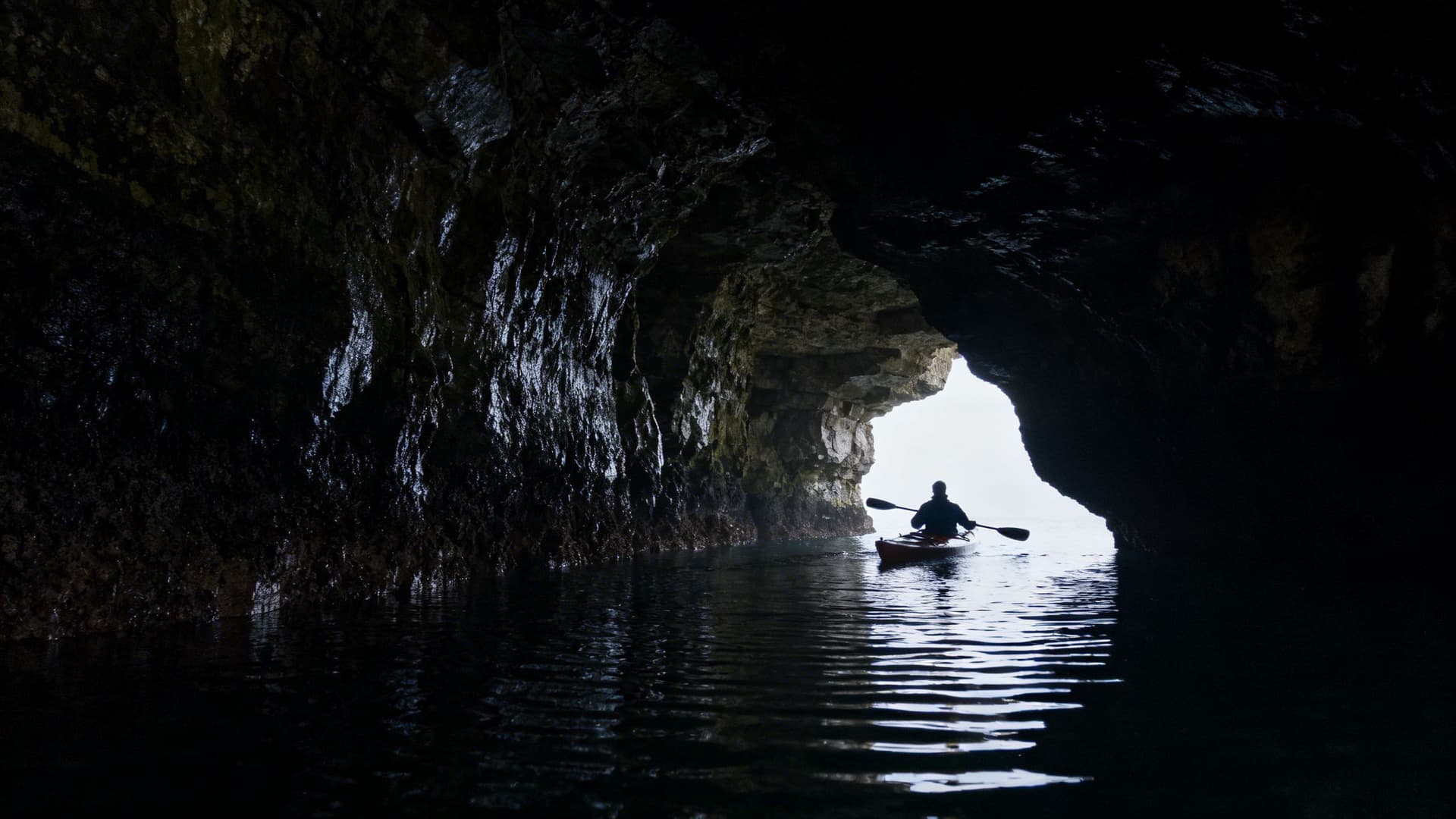
Near Ardara, on the south Donegal coast, a limestone headland drops into the Atlantic and contains a cave system that has been forming for several million years. There are around thirty caves in the Maghera complex, most of them accessible only from the sea. On an extreme spring low tide, with calm conditions and boots designed for the purpose, some of the outer caves can be reached on foot across barnacle-covered rock. By kayak, in the right swell window, the interior of the system opens in a way that walking never reaches.
The chambers vary. Some are wide enough to turn a kayak inside, lit dimly by the opening behind you, the walls dark with moisture and the floor a moving disc of Atlantic water. Others narrow until the hull scrapes and the ceiling drops to within an arm's length of your head, and the sound of water moving through rock — a pressured, oscillating sound unlike anything on open water — fills the space completely. The swell that passes through the outer cave entrance becomes something else inside: slower, more deliberate, lifting and setting the kayak down with the rhythm of something that has been doing this for a very long time.
The caves are not always accessible. Swell windows that allow entry into the inner chambers are narrow, tide-dependent, and change within a single afternoon. A guide who paddles Maghera regularly carries a working knowledge of when those windows occur and what conditions are required to make them safe. Without that knowledge, you paddle to the cave entrance and turn around.
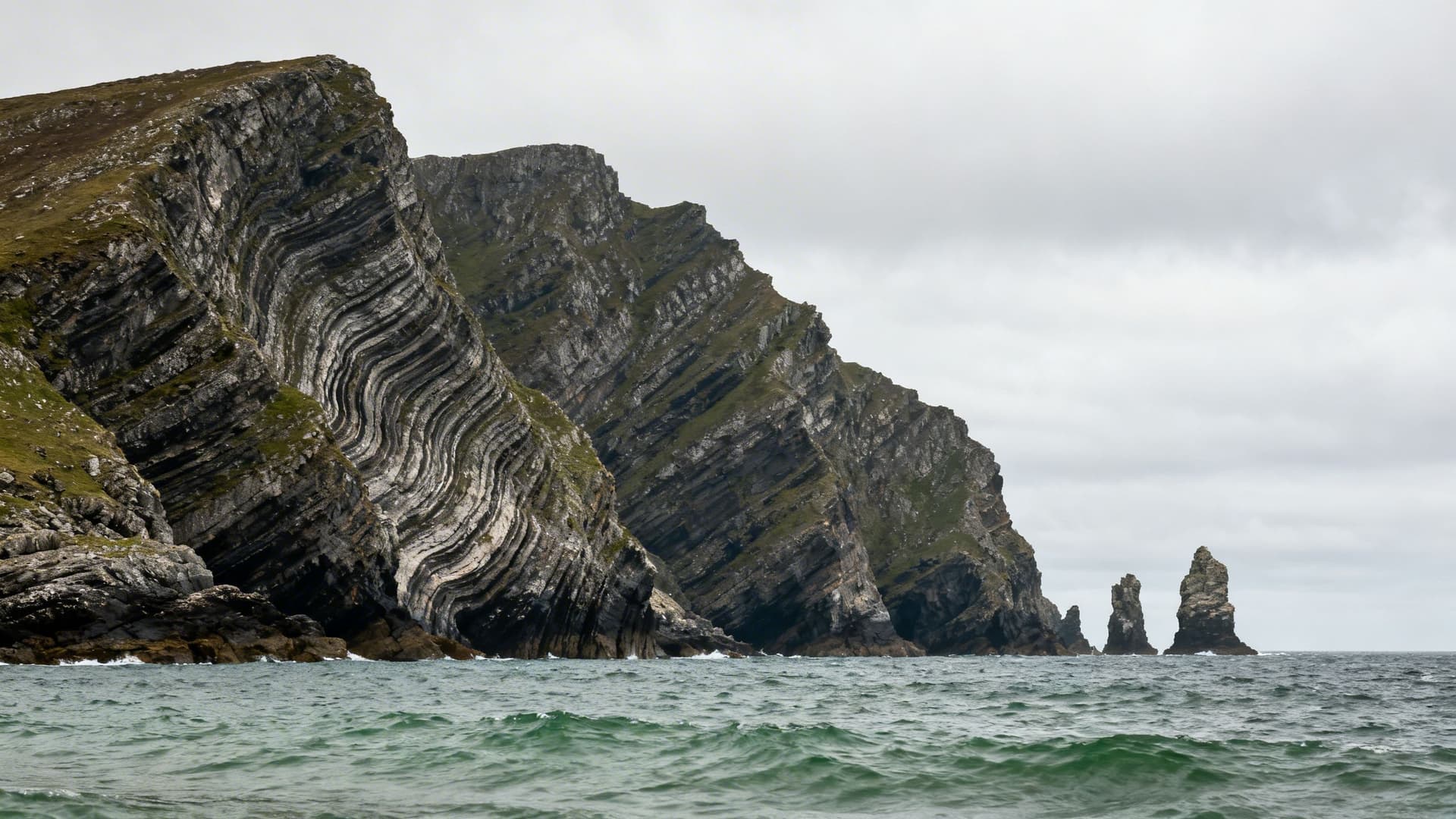
The Sea Stacks and the Northwest Shore
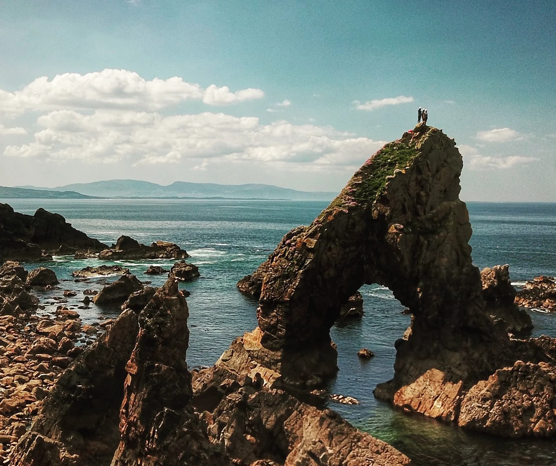
Northwest of Glencolumbkille, the coast breaks into a sequence of headlands, stacks, and offshore rocks that most visitors to Donegal never see. Some stacks stand in sheltered bays close to land; others rise from the open Atlantic a quarter of a mile offshore, accessible only in calm conditions and requiring tide knowledge for a safe circumnavigation. These formations don't appear in most travel accounts of the county. They are too far from any road to feature in photography, and the conditions required to reach them don't occur on any predictable schedule.
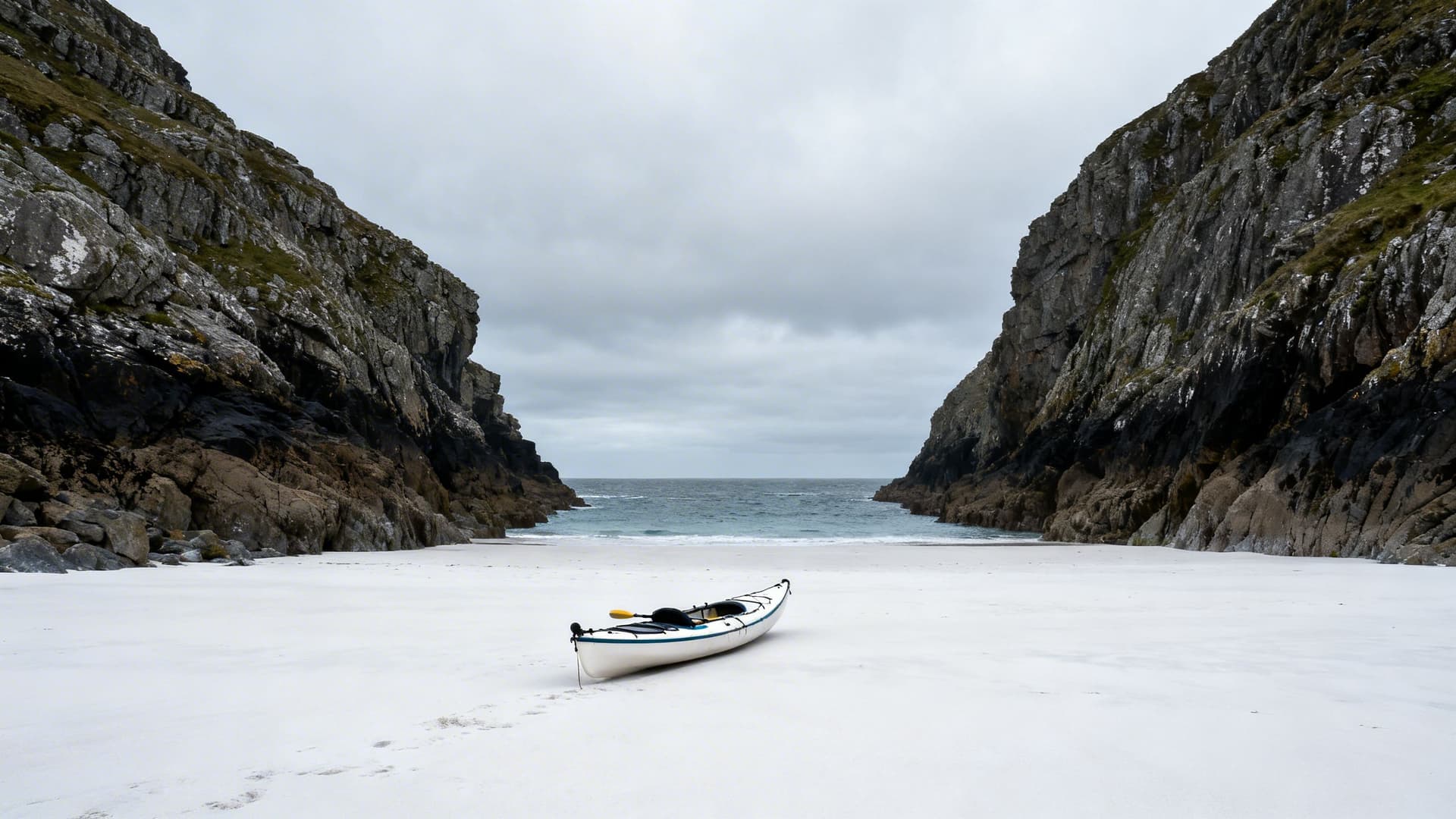
There are beaches in this stretch of coast — strands of white sand enclosed by cliff on three sides — that receive no footfall for weeks at a time. A kayak is the only sensible means of approach for most of them. The experience of landing on a beach that has no path, no car park, no infrastructure of any kind, with the Atlantic behind you and several hundred metres of empty cliff above you, is the particular quality that this coast holds in reserve for those who arrive from the water. For diaspora travellers whose family connections are to Donegal — and they run deep; this was a county that sent a significant portion of its population across the Atlantic across two centuries — landing on empty shore like this can carry a weight that has nothing to do with tourism.
For travellers planning a longer time on the water, Multi-Day Sea Kayaking in Ireland: How to Plan a Paddle Camping Trip on the West Coast covers the logistics of paddle-camping circuits along coastlines like this one — including the Donegal options and what they genuinely require.
Why You Need a Local Guide for Sea Kayaking in Donegal
Donegal's coastline faces directly into the full fetch of the North Atlantic. Swell generated by Icelandic low-pressure systems arrives at the Donegal coast with nothing to interrupt it for two thousand kilometres. The national forecast gives you an Atlantic swell figure, but it tells you nothing about how that swell behaves in the specific geometry of Maghera's headland, or what the refraction off Slieve League's base does to water conditions in the cove to the north of it, or which half-hour window between tides makes Bunglas accessible without risk.
Guides who paddle Donegal's coast regularly build a mental map that accumulates over seasons, not days. They know which sea stack circumnavigations require a neap tide and which are passable on any tide in the right swell. They know the caves that open at 0.4 metres on the tide chart and close at 0.8. They know which headlands generate a backwash that has nothing to do with the conditions in open water. This knowledge does not exist in a database. It is not available via forecast. It is the residue of years of being on the same water in every condition it produces.
A Donegal sea kayaking guide is not, on this coast, the difference between a good experience and a bad one. It is the difference between accessing this coast at all and spending a day looking at it from the car park at Malin Beg. For those who are newer to sea kayaking and want to understand what working with a guide actually involves before planning a route like this, Sea Kayaking for Beginners in Ireland: What Your First Session Will Actually Feel Like covers that in full.

Frequently Asked Questions
Is sea kayaking in Donegal suitable for beginners?
With a qualified guide, yes — on the right day and in the right location. Not every section of the Donegal coast requires experience; there are protected bays along the south Donegal shore where conditions are manageable for paddlers with no background. Slieve League and the Maghera cave sections require more stable sea conditions and some basic paddle confidence. A good operator will match the route to the group's level and will not run a challenging section unless conditions on that specific day make it viable.
When is the best time of year to kayak the Donegal coast?
May, June, and September offer the most settled Atlantic conditions. July and August bring longer light and warmer air temperatures, but swell from summer Atlantic low-pressure systems can be less predictable than the calendar implies. The Donegal coast in October, in the right conditions, offers a quality of light and silence that a small number of paddlers return for specifically — the angle of the sun on Slieve League's iron-stained rock at that time of year is something that doesn't reproduce in summer.
Can I reach the Maghera caves by kayak?
Yes, with the right guide and in the right conditions. The outer caves are accessible in a wider range of conditions; the inner chambers require a narrower swell window and specific tidal timing. A guide who paddles Maghera regularly will know whether that day's conditions allow access to the full system. Attempting it independently without local knowledge of the swell pattern on that headland is not advisable.
What makes Donegal different from other kayaking destinations in Ireland?
Scale and remoteness. Donegal's northwest coast has longer uninterrupted stretches of inaccessible shoreline than anywhere else in Ireland. The combination of high sea cliffs (Slieve League), an extensive cave system (Maghera), exposed sea stacks, and remote beaches means that a series of days kayaking here can cover ground that has a genuinely different character each time. The other element is the Atlantic exposure: Donegal faces more directly into open ocean swell than the more sheltered inlets of Connemara or Kerry, which makes local guide knowledge correspondingly more consequential.
Donegal is not the easiest coast to paddle. That is precisely what reserves it for those who choose to arrive from the water rather than the road. The shore visible from land is a fraction of what exists here — a promise, rather than the place itself. For travellers using Sea Kayaking in Ireland: A Complete Guide to plan a west coast trip, Donegal rewards being saved for when conditions are right, and approached with a guide who has spent years learning what right looks like on this particular stretch of the Atlantic.
Table of Contents
Share this post
More from the Blog

The History of Wren Day in Ireland: From Pagan Ritual to Modern Parade
Trace the history of Wren Day in Ireland from pagan midwinter customs and the legend of St. Stephen to the surviving street processions of today.

Hunt the Wren in Dingle: Ireland's Most Famous Wren Day
Dingle hosts Ireland's most famous Wren Day celebration. This guide explains the parade, the costumes, the music, and how to experience Hunt the Wren like a local.

Hunt the Wren in Ulster: Northern Ireland's Wren Day Traditions
Discover Hunt the Wren in Ulster. Learn about Wren Day traditions in Fermanagh, Tyrone, and across Northern Ireland, from house visits to street processions.