
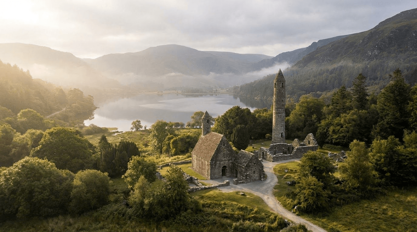
Vikings & Valhalla: Exploring 'Kattegat' at Lough Tay
The fjords of Norway, where Vikings sailed and settled — they're in Wicklow. Not Norway. Ireland. Specifically, Lough Tay, a lake so private that most Irish people have never been closer than the road skirting its eastern edge.
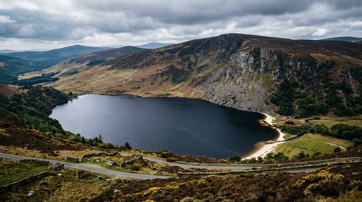
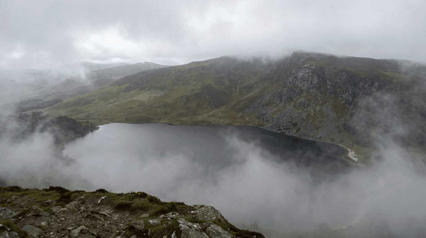
When History Channel needed a location for Kattegat, they found it at Lough Tay. The lake sits in a glacial valley surrounded by mountains. Dark peaty water and a white sand beach create the visual effect known as "the Guinness Lake" — like a pint of stout. From certain angles, it looks like a Norwegian fjord.
The production filmed at Lough Tay for six seasons of Vikings and returned for Vikings: Valhalla. They built a settlement on the shore and launched longships from the beach. Millions of viewers assumed it was Scandinavia. Very few could actually visit — the estate doesn't permit public access.
This guide explains what you can and cannot see at the Vikings filming location. The lake is private, but the views from the road are spectacular. Understanding the difference between what the show portrayed and what's accessible is essential for any visitor.
Why Lough Tay Became Kattegat
The Fjord Problem
Vikings is an expensive production. Building sets, launching ships, and filming battle sequences requires space, security, and consistent conditions. Norway's actual fjords are spectacular but impractical — weather is unpredictable, access is difficult, and local regulations limit what productions can build and destroy.
Lough Tay offered solutions. The valley creates a natural bowl, blocking wind and providing shelter for sets and equipment. The lake is small enough to manage but large enough to look substantial on camera. Most importantly, it's on the Luggala Estate, owned by the Guinness family for generations, which meant the production could negotiate exclusive access and build what they needed without public interference.
The visual match is surprisingly good. The dark water reads as deep and cold on camera. The surrounding mountains provide the vertical scale of fjord walls. The white sand beach functions as a shoreline where longships can land and Vikings can gather. With careful camera placement and some digital enhancement in post-production, Lough Tay becomes convincingly Nordic.
The Access Agreement
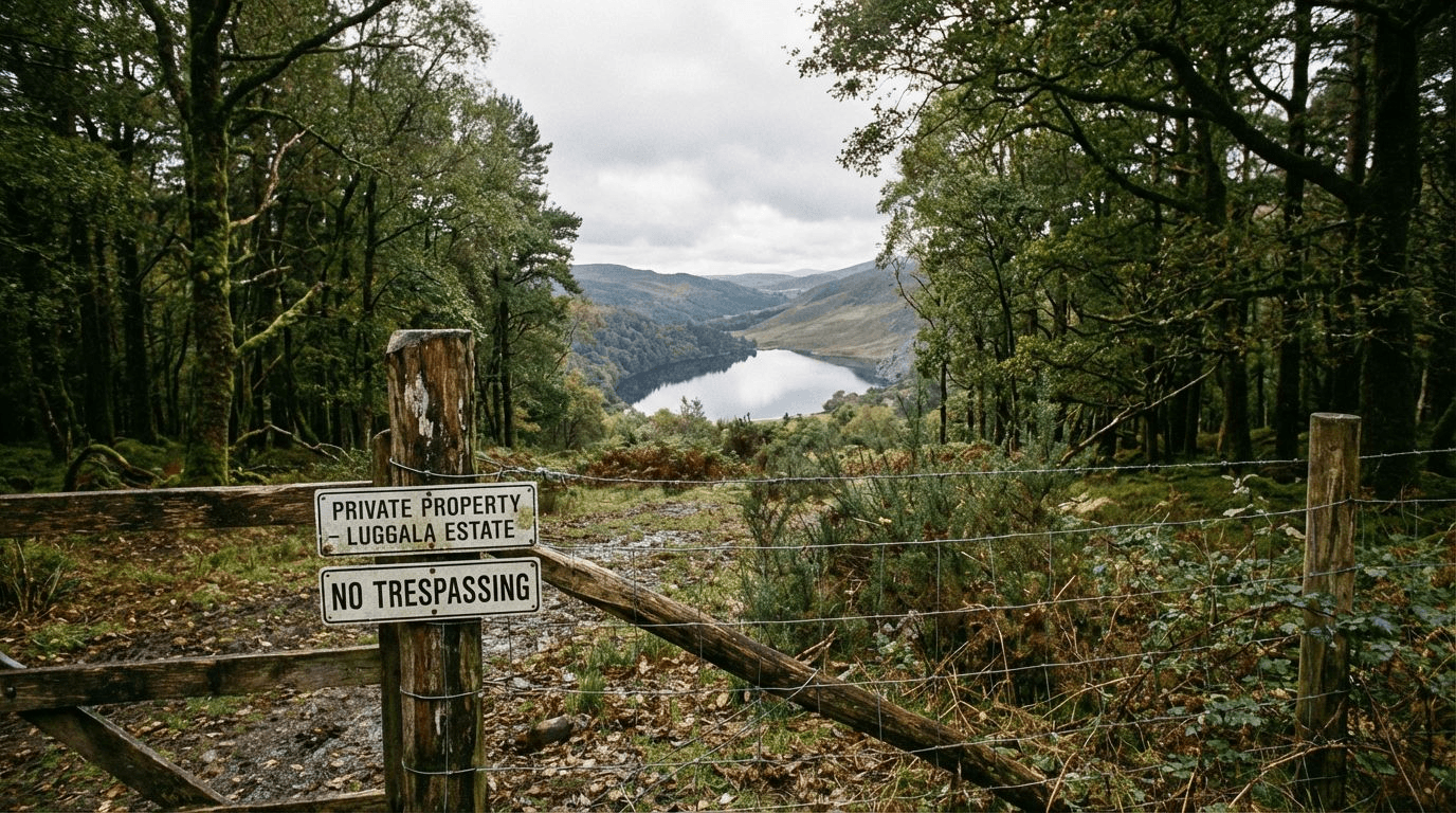
The Vikings production negotiated exclusive use of Lough Tay for filming periods. This isn't public land — it's private property, and the estate exercises control strictly. During filming, the entire lake was closed to anyone not directly involved with the production. Security patrolled the boundaries.
What the production built was substantial. The Kattegat settlement included multiple buildings, docks for the longships, and various set pieces required for daily filming. After each season, the set was either dismantled or modified for the next season's requirements. Nothing permanent remains on the shore today.
The key point: The production had permission visitors don't have. The estate's position hasn't changed — the lake remains private, and trespassing is actively enforced.
What You Can Actually See
The Military Road Viewpoints

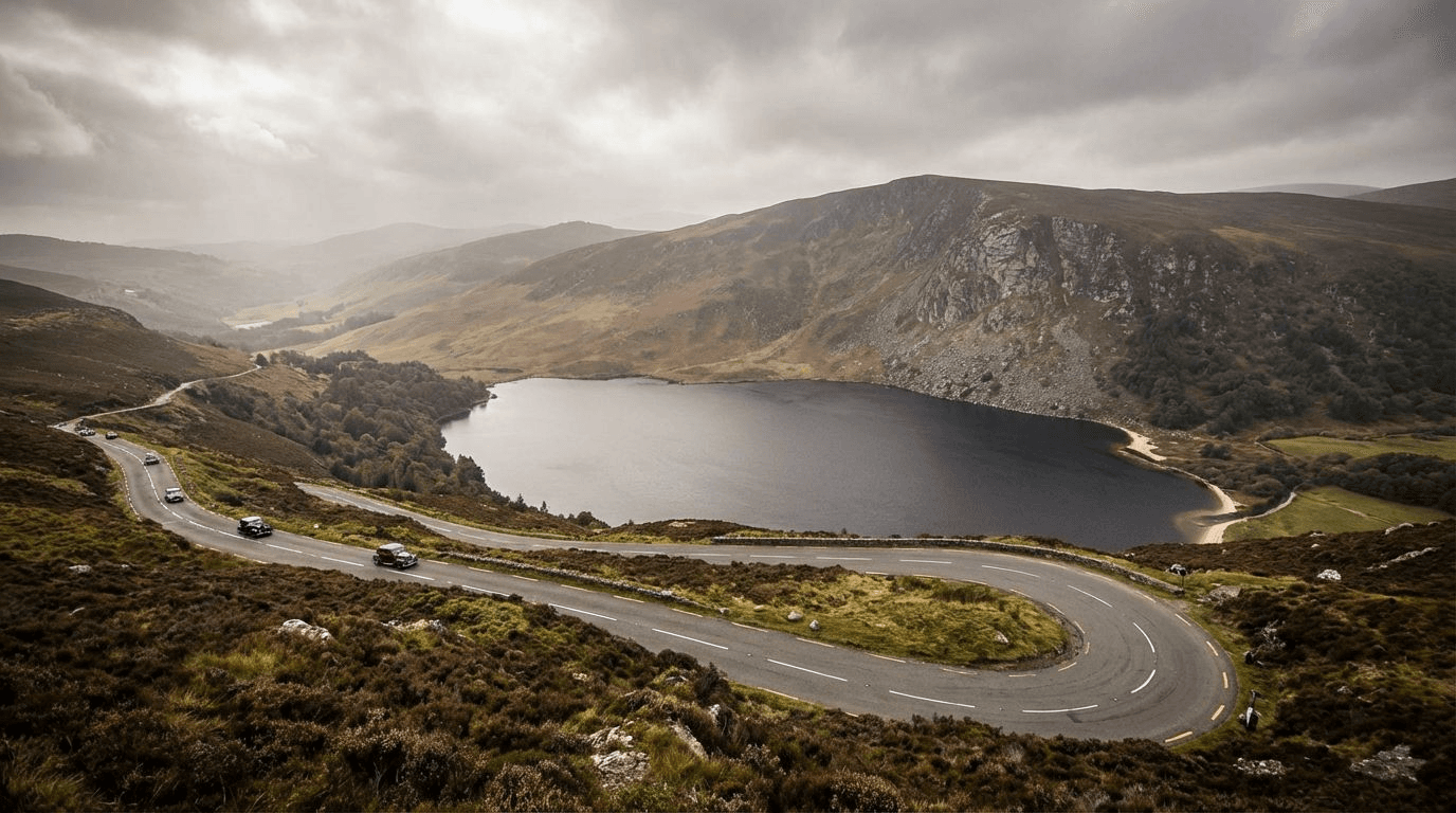
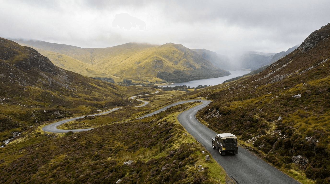
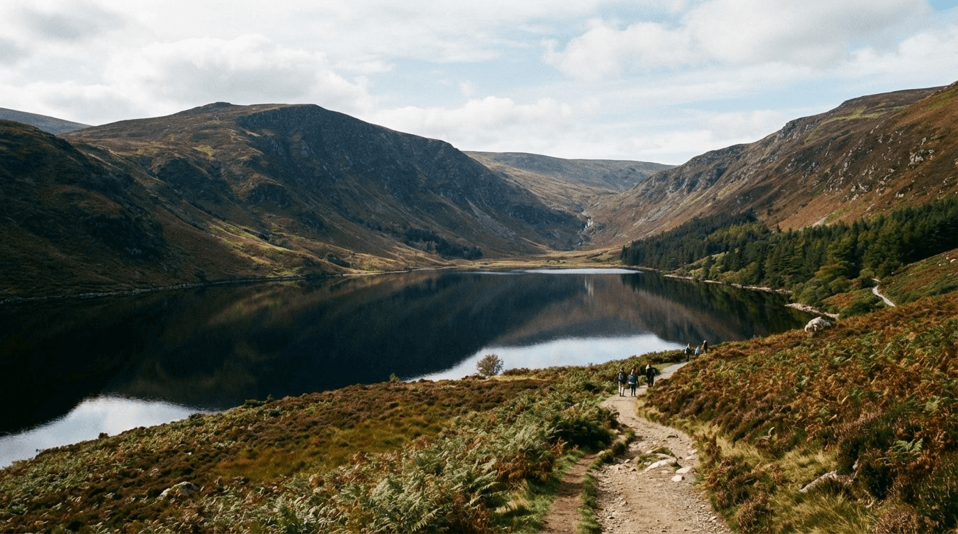
The R759, known locally as the Military Road, runs along the eastern side of the Lough Tay valley. From several laybys and informal pull-offs, you get clear views down to the lake. These viewpoints are public — you're on a public road, looking at private land. This is the legitimate way to see Lough Tay.
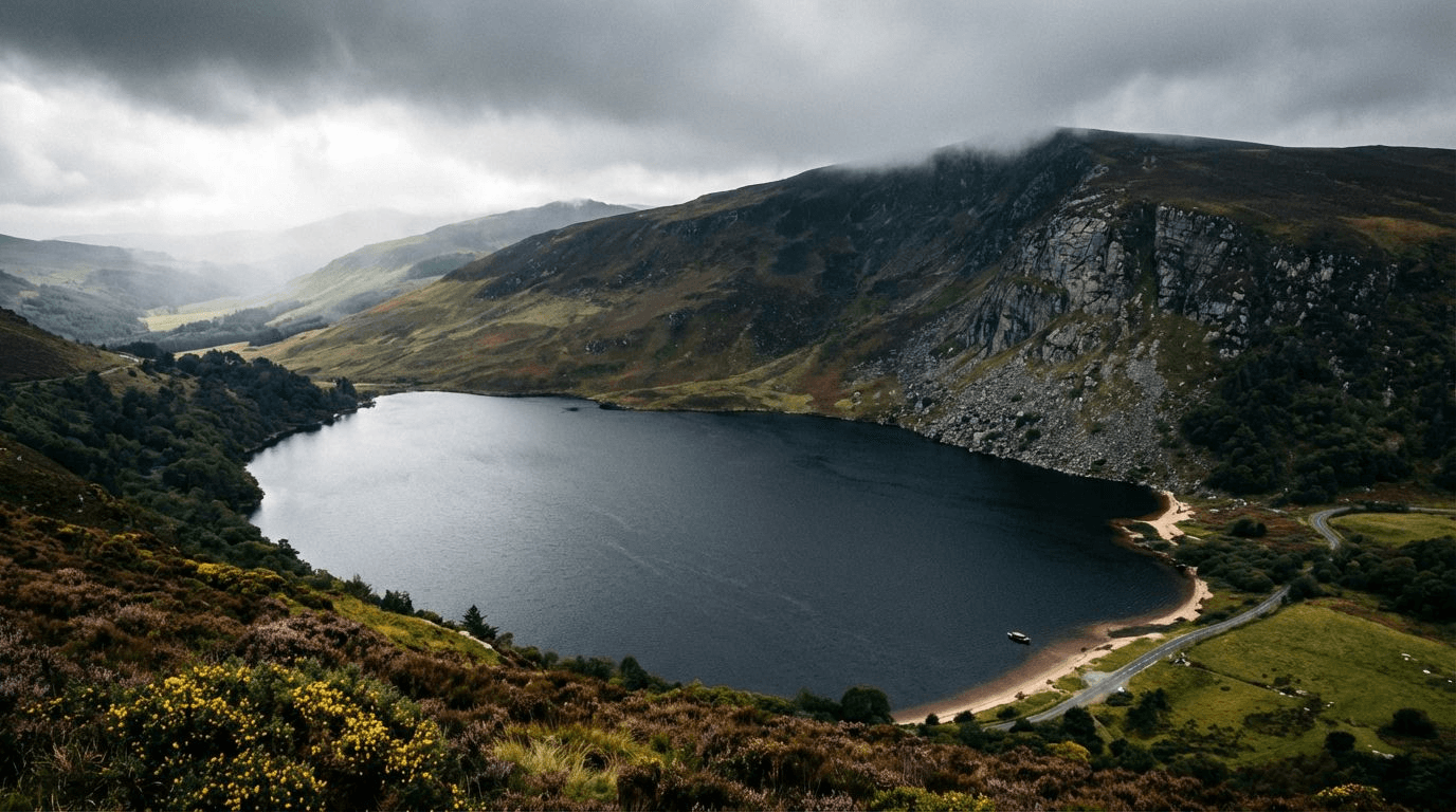
The most famous viewpoint is known as "the Vee" — a hairpin bend where the road swings west and the view opens up. On clear days, you can see the full length of the lake, the white sand beach at the northern end, and the mountains beyond. On misty days, the atmosphere is arguably better — the lake appears and disappears in cloud, creating exactly the kind of dramatic backdrop the Vikings cinematographers used.
Photography from the road: You can take excellent photos from the viewpoints. The lake is roughly 200 metres below road elevation. A zoom lens helps, but phone cameras capture the scene. Best light is morning or late afternoon.
The Access Reality
Here's what you need to understand about visiting Lough Tay: you cannot go down to the water. The estate employs security personnel who patrol the boundaries. Fences, gates, and natural barriers prevent access from the road. Attempting to reach the shore constitutes trespassing, and the estate has prosecuted violators.
This isn't arbitrary elitism. Lough Tay is a drinking water source, and the estate has legitimate reasons to control access. The Vikings production negotiated specific terms, paid significant fees, and carried insurance. Individual visitors don't have those arrangements.
The practical implication: Plan your visit around the viewpoints, not the shore. Bring binoculars if you want to see detail. Take photographs from the road. Accept that the closer access you see in the TV show required permissions and arrangements unavailable to tourists.
The Surrounding Area: Real Viking History
Glendalough's Monastic Vikings
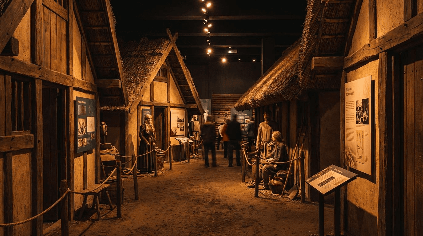
While Lough Tay itself offers limited access, the surrounding Wicklow Mountains contain genuine Viking history. Glendalough, the sixth-century monastic settlement, was raided by Vikings multiple times between the ninth and eleventh centuries. The round tower, built partly in response to these raids, still stands.
The Glendalough Visitor Centre has exhibits on the Viking period, explaining how the monastery functioned, why it attracted raiders, and how the monks responded. The walking trails around the upper and lower lakes pass sites with Viking associations. This isn't filmed history — it's actual history, documented and preserved.
The strategic value: If you're interested in Vikings, Glendalough provides context that the filming location cannot. You can walk where Vikings walked, see structures they saw, and understand their presence in Ireland as part of a larger historical pattern.
The Dublin Connection
Vikings established Dublin as a trading settlement in the ninth century. The city was a hub of Viking activity for three centuries before the Norman invasion. Today, the Dublinia museum and various archaeological sites preserve this heritage.
From Lough Tay, Dublin is approximately 50 kilometres northeast. You can combine a Wicklow viewpoint visit with Dublin's Viking heritage in a single day. The contrast is instructive — the dramatic filming location in the mountains, and the commercial reality of Viking Dublin on the coast.
Meet a Local Guide
Hi Folks,
For visitors wanting depth: The National Museum of Ireland's Archaeology branch has an extensive Viking collection, including the famous Wood Quay excavations. This material isn't reproduced anywhere else in the country.
Practical Information for Visitors
Getting to the Viewpoints
Lough Tay is most commonly approached from the south, via the R759 from Roundwood. The road is narrow, winding, and occasionally challenging. From Dublin, the route is approximately 45 kilometres — expect an hour's driving time, more if you're unfamiliar with Irish rural roads.
The approach: The final five kilometres climb steadily into the Wicklow Mountains. The landscape changes from farmland to moorland to mountain valley. When you see the lake appear below you, you're at the viewpoints.
Parking: There are no formal car parks at the viewpoints. You pull onto the verge where it's safe and wide enough. On busy weekends, parking can be challenging — the road is narrow and passing places are limited. Weekday mornings offer the best chance of finding space.
Weather and Timing
Wicklow weather changes rapidly. The valley that creates Lough Tay also traps clouds and mist. You might arrive to find the lake completely obscured, wait twenty minutes, and watch it emerge as the cloud lifts.
Best conditions: Clear or partly cloudy days, particularly after rain when the atmosphere is washed clean. Morning light illuminates the lake from the east. Late afternoon creates longer shadows and more dramatic contrast.
Worst conditions: Complete white-out fog, which makes the lake invisible and the road hazardous. Heavy rain, which limits visibility and makes photography difficult. Check weather forecasts before making the drive.
The Ethics of Viewing Private Land
Photography and Social Media
Thousands of photographs of Lough Tay appear on Instagram, marked with location tags and Vikings references. This creates a misleading impression — the photos suggest accessibility that doesn't exist. Visitors arrive expecting to walk the shore, then find themselves limited to roadside viewpoints.
Responsible posting: If you share Lough Tay photographs, consider mentioning that the lake is private and viewpoint-only. This manages expectations and prevents disappointment. The location is visually spectacular regardless of access limitations — there's no need to pretend it's something it's not.
Alternatives to Access
If you want the Vikings experience without the access restrictions, several alternatives exist:
The Luggala Estate Open Days: Very occasionally, the estate opens for charity events or specific occasions. These are rare, announced with little notice, and typically don't include lake access. But they do offer a glimpse of the estate that normal visitors cannot see.
Other Wicklow Lakes: Lough Dan and Lough Bray offer similar mountain-lake scenery with public access. Neither was used for Vikings filming, but both provide the kind of landscape that drew the production to Wicklow.
The Wild Atlantic Way: For genuine coastal scenery with public access, Ireland's west coast offers dramatic alternatives. The Cliffs of Moher, the Ring of Kerry, and the Donegal coastline provide accessible viewpoints with spectacular scale.
Final Thoughts: The Illusion of Access
Vikings created compelling television partly through location choice. Lough Tay looks like Norway, feels remote, and photographs beautifully. The production's access allowed them to use the location fully — building sets, launching ships, filming from the shore.
Visitors don't have that access. What you can see is genuinely impressive — the lake, the mountains, the atmosphere. But it's a view, not an experience. You cannot walk where Ragnar walked, touch the water where longships landed, or explore the settlement built for filming.
This isn't a reason to avoid Lough Tay. The viewpoint is worth the drive, particularly if you're combining it with other Wicklow attractions. But approach with realistic expectations. The Vikings location is a visual destination, not an interactive one. Enjoy the view, take the photographs, and understand that what you see on screen required permissions and arrangements beyond what tourism provides.
For Cinematic Ireland: The Ultimate Guide to Film & TV Locations — the master hub
For more film locations:
- Star Wars in Ireland: How to Visit Skellig Michael & Malin Head
- The Banshees of Inisherin: Visiting Achill Island & Inis Mór
- Game of Thrones Territory: Dark Hedges & Winterfell
- Braveheart in Meath: Why Trim Castle is the Real York
- P.S. I Love You: A Romantic Guide to the Wicklow Mountains
- Saving Private Ryan: Why Curracloe Beach is Better Than Normandy
Table of Contents
Share this post
More from the Blog

The History of Wren Day in Ireland: From Pagan Ritual to Modern Parade
Trace the history of Wren Day in Ireland from pagan midwinter customs and the legend of St. Stephen to the surviving street processions of today.

Hunt the Wren in Dingle: Ireland's Most Famous Wren Day
Dingle hosts Ireland's most famous Wren Day celebration. This guide explains the parade, the costumes, the music, and how to experience Hunt the Wren like a local.

Hunt the Wren in Ulster: Northern Ireland's Wren Day Traditions
Discover Hunt the Wren in Ulster. Learn about Wren Day traditions in Fermanagh, Tyrone, and across Northern Ireland, from house visits to street processions.