
Ireland's Hidden Heartlands: The Insider Guide to Ireland's Quietest Region
Ireland's Hidden Heartlands: The Insider Guide to Ireland's Quietest Region
The phrase you hear from people who grew up in this part of Ireland is "sure, there's nothing here." They don't mean it as a complaint. They say it with the particular affection of someone who has lived their whole life somewhere the tourists drove through without stopping, and considers this a reasonable arrangement. The lakes, the drumlins, the eskers left by retreating glaciers fifteen thousand years ago, the abbey ruins visited mostly by crows — none of it required the validation of a travel itinerary to be what it is.
Ireland's Hidden Heartlands is the name Fáilte Ireland gave to a branded trail stretching across the central and northwest midlands — a region that had been, for decades, the least-visited part of the island's interior. The counties are Cavan, Roscommon, Leitrim, Longford, and Westmeath, with the trail also pulling in the UNESCO-designated geology of County Fermanagh to the north. What connects them is water — the River Shannon and its tributaries, the Erne system, the drumlins scattered by ice into a landscape of small hills and lake-filled hollows that has no equivalent in Ireland and very few in Europe.
This guide covers all of it. If you're deciding where to go or what to prioritise, the county guides go deeper: Things to Do in Cavan, Things to Do in Leitrim, and Marble Arch Caves are the best starting points for first-time visitors to the region.
What Ireland's Hidden Heartlands Actually Is
Before the branded trail existed, the region had another kind of reputation: the part of Ireland you pass through on the way to somewhere else. Midlands, people said, with a particular flatness of tone. The word conjured bog and motorway and not much else.
The Heartlands rebrand was, in marketing terms, an attempt to change that. In geographic terms, the region was always coherent — a continuous landscape of glacial landforms, waterways, and limestone karst stretching from the Fermanagh border south to the river's upper reaches in Westmeath. The Shannon rises at the Shannon Pot in County Cavan; it widens into lakelands through Roscommon, Longford, and Westmeath before leaving the region south of Athlone. The Erne system mirrors it from the north, flowing from Lough Gowna through Cavan and into Fermanagh. This is a water-defined landscape, and that tells you something about how to move through it.
The five counties combined have a population of roughly 330,000 people. Roscommon, with its 66,000 people spread across 2,548 square kilometres, is among the least densely populated counties on the island. This is not a problem to be solved. It is the defining condition of the travel experience — one that rewards the visitor who can slow down and let the landscape show itself on its own terms.
County Cavan: Limestone Country and the Shannon Headwaters
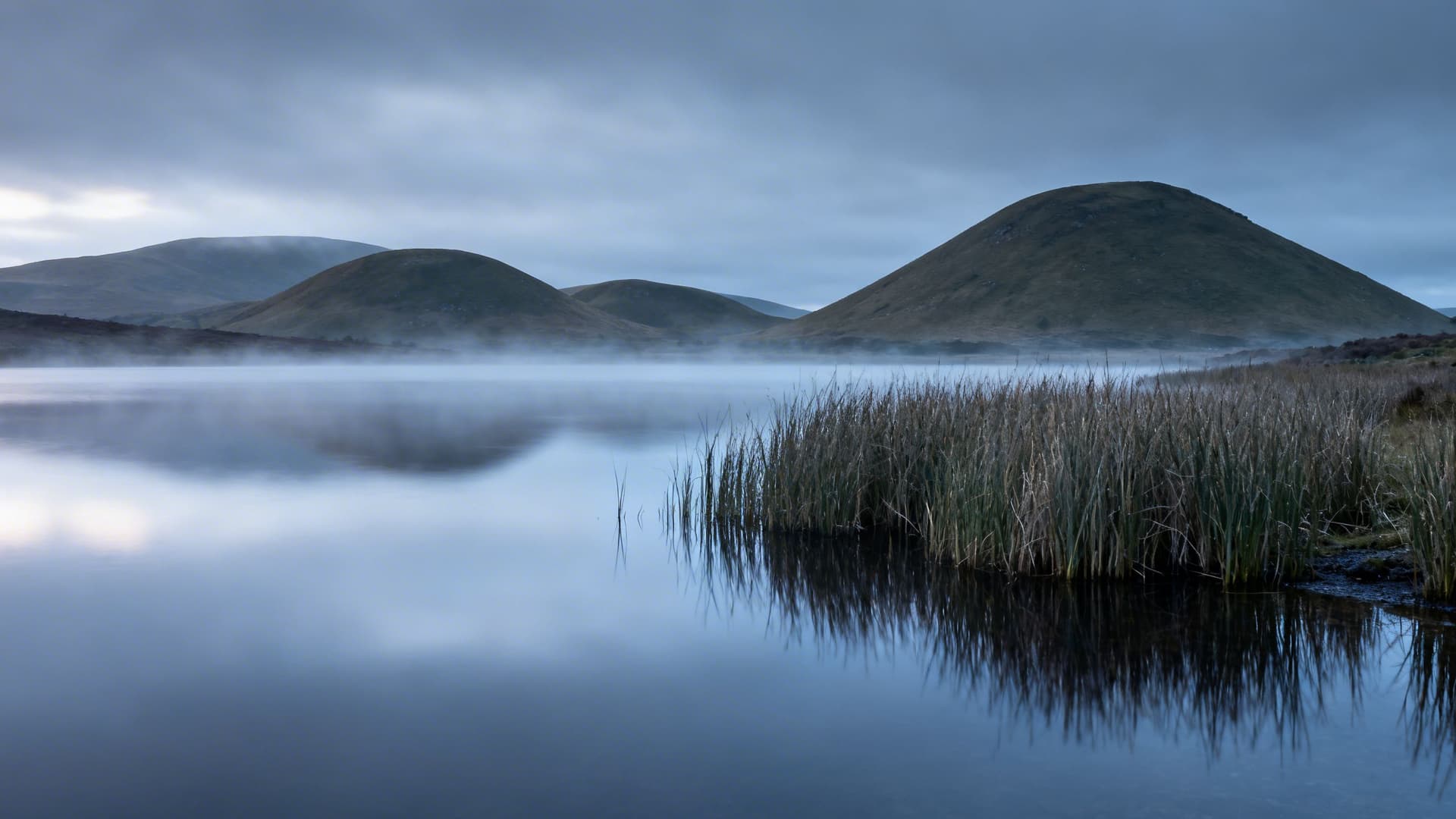
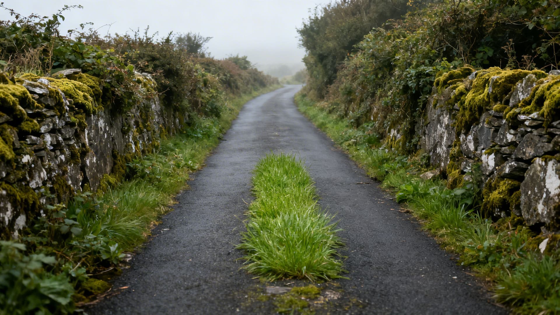
Cavan is drumlin country in its most extreme form — a county of more than 180 lakes, drumlin hills rolling in every direction, boreens that follow field boundaries rather than any logical compass bearing, and a northern border that runs along the edge of the same Fermanagh limestone plateau that produces Marble Arch Caves. The county town is small, the villages are smaller, and almost everything worth seeing requires knowing where to look.
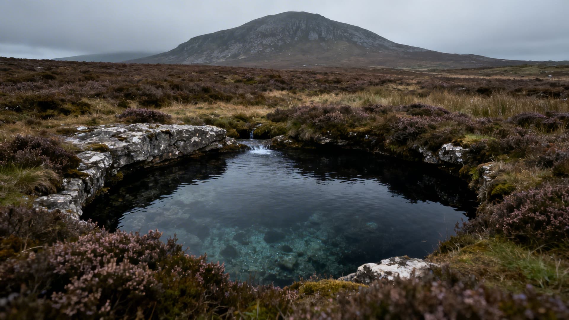
The Shannon Pot is the most celebrated spot — a circular pool in the Cuilcagh Mountain plateau where the River Shannon emerges from underground limestone passages, apparently from nowhere, to begin a 360-kilometre journey to the Atlantic. It is remarkable in itself. Getting there, along the mountain track from Dowra, is half the point: the approach through blanket bog, with Cuilcagh rising above and the absence of any other walkers, is the Cavan experience condensed. Clough Oughter Castle, rising from an island in Lough Oughter on no road any sat-nav knows, is equally emblematic.
The Cavan Burren in the south of the county is the easiest introduction to the region's geology — a limestone pavement landscape with prehistoric court tombs, forest trails, and interpretive signage that manages to be informative without becoming a theme park. Things to Do in Cavan covers the full county, including the Moneygashel Cashel, Killykeen Forest Park, and how to navigate Cavan without spending the day turning the car around.
County Leitrim: Ireland's Least-Known County, Deliberately
Leitrim is the smallest county by population in Ireland and, in recent years, one of the fastest-growing — the result of remote workers and returnees discovering what locals have always known: that the land is cheap, the landscape is exceptional, and the solitude is not the absence of something but a quality in itself.
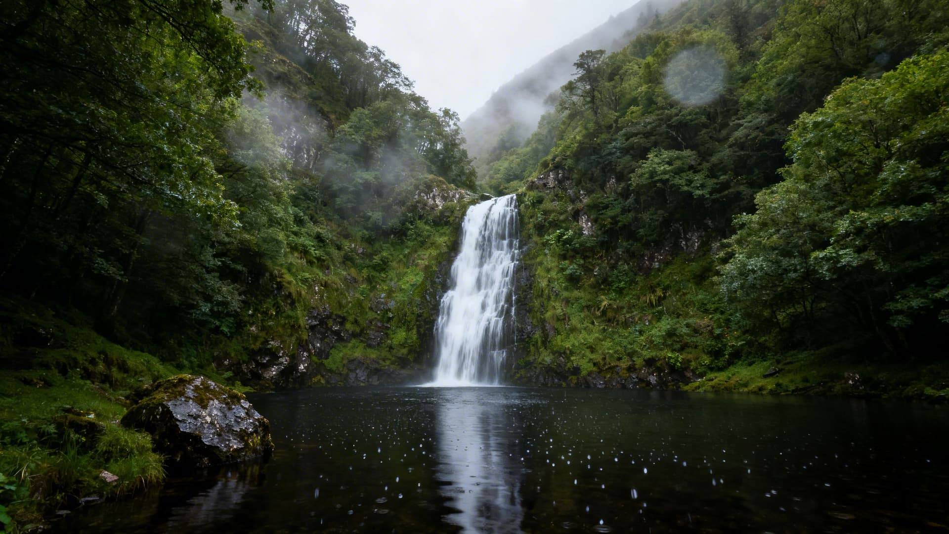
The county has two very different characters divided by Lough Allen. Northern Leitrim is upland — Glenade, Glencar, the Iron Mountains, the approaches to the sea cliffs at Benwiskin in the northwest. Glencar Waterfall, celebrated by Yeats and still deserving the attention, sits in a valley that feels improbably lush for its northerly position. Eagle's Rock above Glenade is the most dramatic limestone escarpment in this part of Ireland, with a pair of golden eagles re-established here after a long absence.

Southern Leitrim opens into the waterways — the Shannon-Erne Blueway connecting Lough Allen to the Erne system, the river towns of Carrick-on-Shannon and Leitrim village. Parke's Castle on Lough Gill crosses the border into Sligo in spirit if not quite in geography. Things to Do in Leitrim maps both halves of the county with the full guide to Creevelea Abbey, the blueway, and the practicalities of navigating what is, by design, one of Ireland's least-sign-posted destinations.
County Roscommon: The Mythic Midlands
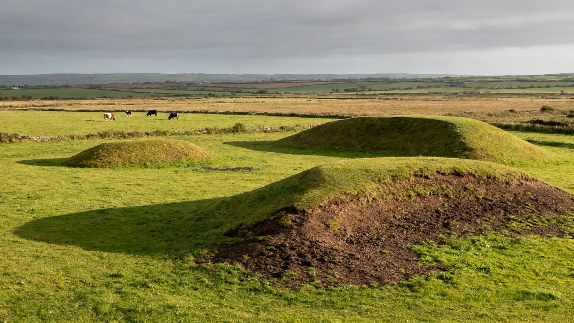
Roscommon has a claim to being the historical centre of Ireland that Tara gets all the credit for. Rathcroghan, in the north of the county, is a complex of over sixty earthwork monuments — royal enclosure, burial mounds, ceremonial sites — spread across open farmland with a single interpretive centre and, most days, no other visitors. The Irish mythology of the Ulster Cycle — the epic of Cúchulainn, the cattle raid of Cooley, the court of Queen Medb — plays out here. The scale of the archaeological landscape, and the casualness of access to it (you walk across fields, past grazing cattle, with only the grass underfoot to tell you this is consecrated ground), is unlike anything managed and ticketed elsewhere in Ireland.
Boyle Abbey, a Cistercian foundation of 1161, is the most complete monastic ruin in Connacht. Roscommon Castle sits in the middle of the county town with the unassuming air of something that has been there since the 13th century and expects to remain. Lough Key Forest Park, north of Boyle, has the formal trappings of a family amenity but also, within its forest trails, more silence and birdsong than most people find in a week's walking in Ireland.
The east of the county — Strokestown Park, the Famine Museum, the Royal Canal — carries heavier historical freight. Things to Do in Roscommon covers the full county, including the Derryglad Museum and Suck Valley Way, alongside the practical guidance for the roads that do not appear on most route planners.
County Longford: The Quietly Remarkable One
Longford is perhaps the most underestimated county in this cluster — and that is a strong competitive field. Its main artery is the N5, which passes through without stopping. Most people who have driven across Ireland have passed through Longford without realising they were there, which is, in one reading, a problem, and in another, an asset.
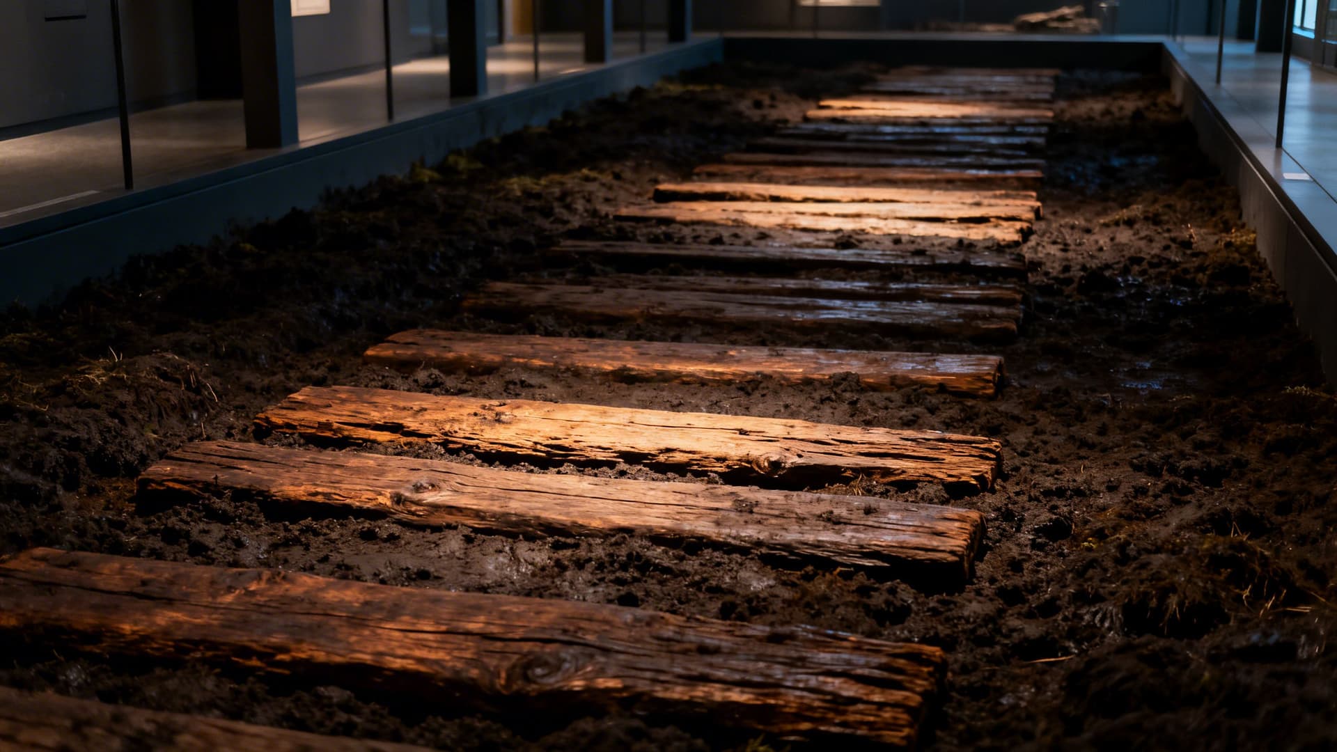
The Corlea Trackway, two kilometres south of Kenagh, is a preserved Iron Age bog road — eighteen metres of oak planks laid across blanket bog in 148 BC, now exhibited in a purpose-built building that maintains the humidity of the original bog environment. It is extraordinary, and extraordinary specifically in the way the Hidden Heartlands does extraordinary: quietly, without fanfare, in a building that seats perhaps twenty people, at the end of a road you would not take unless you knew to.
St Mel's Cathedral in Longford town is, in the strictest architectural sense, one of the finest Gothic Revival buildings in Ireland — rebuilt after a devastating Christmas Day fire in 2009 with a restoration so meticulous it absorbed a decade of work and €30 million. The Royal Canal Greenway connects the county to Dublin by water-rail trail, the Maria Edgeworth Centre in Edgeworthstown covers one of the genuinely important writers of the 18th century, and Newcastle Wood in the east has a Shannon callows walk that sees almost no visitors in any season. Things to Do in Longford gives the complete guide.
County Westmeath: The Lakelands at Their Broadest
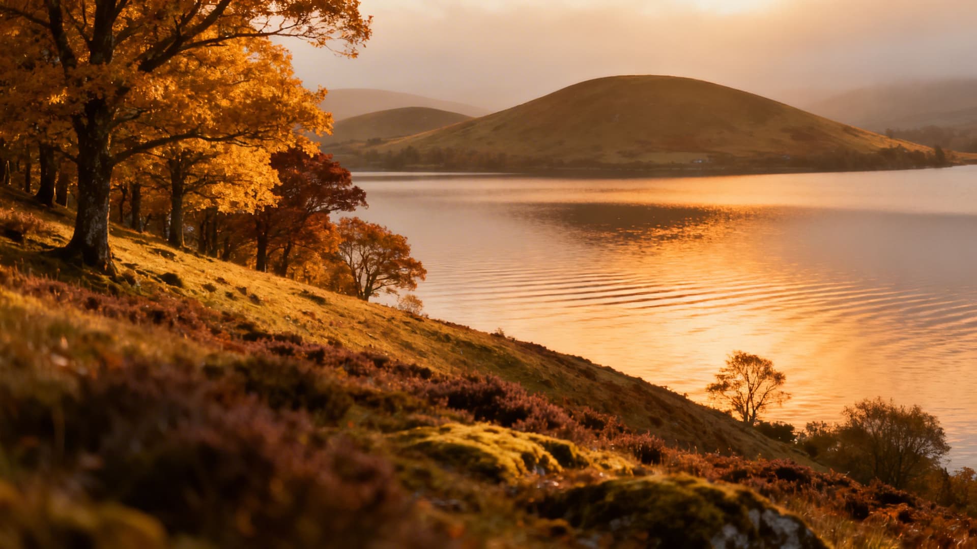
Westmeath is the most accessible county in the cluster — Athlone is on a main rail line, the motorway runs along its southern border — and yet the county away from the town remains thoroughly untravelled. The midland lakes here (Lough Ree, Lough Derravaragh, Lough Sheelin, Lough Lene) form an inland sea that kayakers and narrowboaters have worked out, while the hiking trails along the lakeshore and through the drumlin country above remain quiet even in high summer.
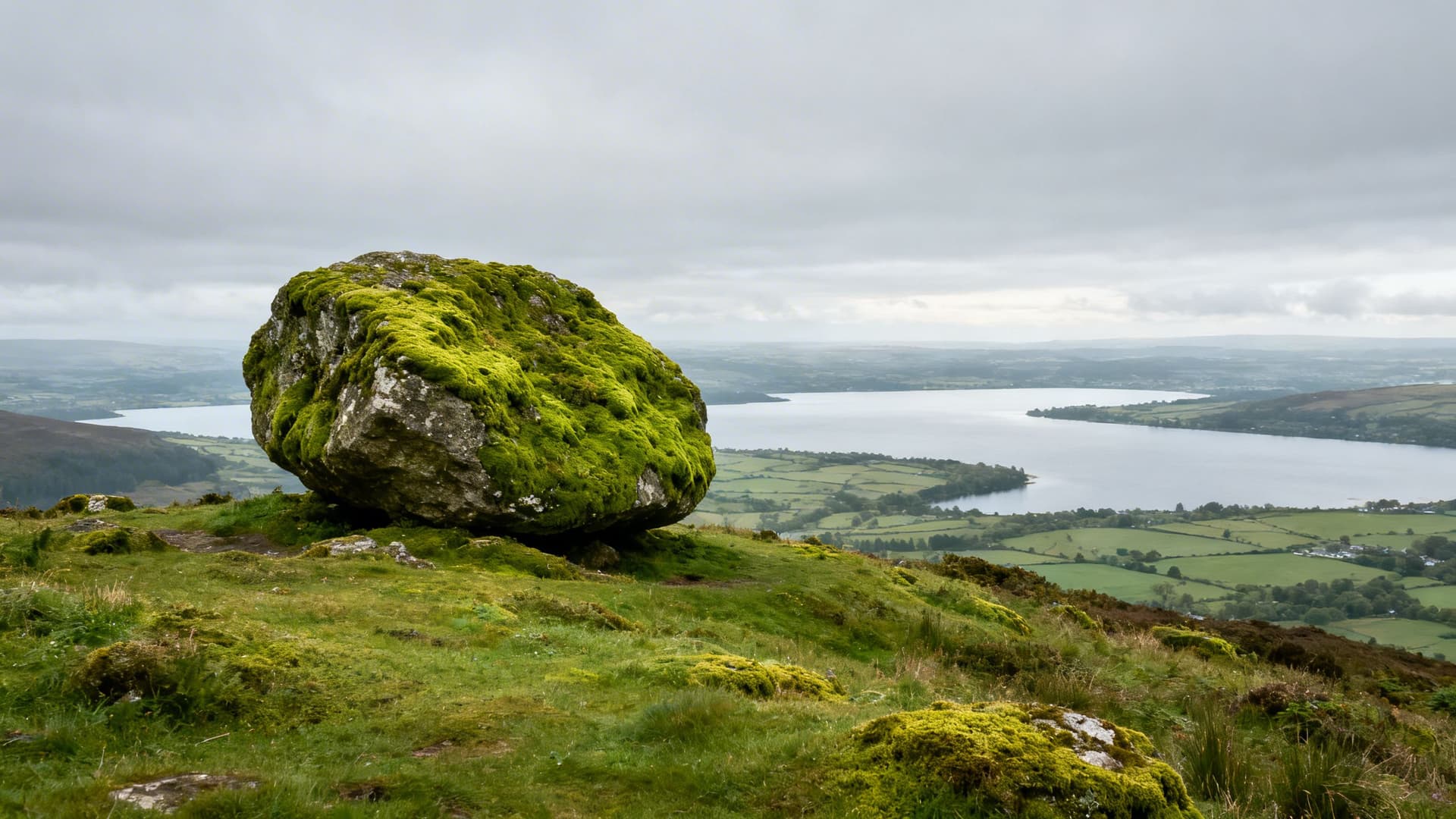
The Hill of Uisneach, in the geographic centre of Ireland, is a ceremonial hilltop with a 5,000-year archaeological history — the ancient inauguration hill of the High Kings, the sacred site of the fire festival of Bealtaine, a Neolithic presence that predates all recorded Irish history. The Cat Stone at its summit, a glacial erratic deposited here by ice and used by successive cultures as a ritual marker, is one of the most atmospheric prehistoric sites in Ireland and is visited by a fraction of the people who queue for Newgrange. Belvedere House, Fore Abbey, and the intact medieval town wall fragments at Athlone all repay more attention than they receive. Things to Do in Westmeath covers the county with the full guide to Locke's Distillery and the broader lakelands walking routes.
Marble Arch Caves: The Geological Northern Edge
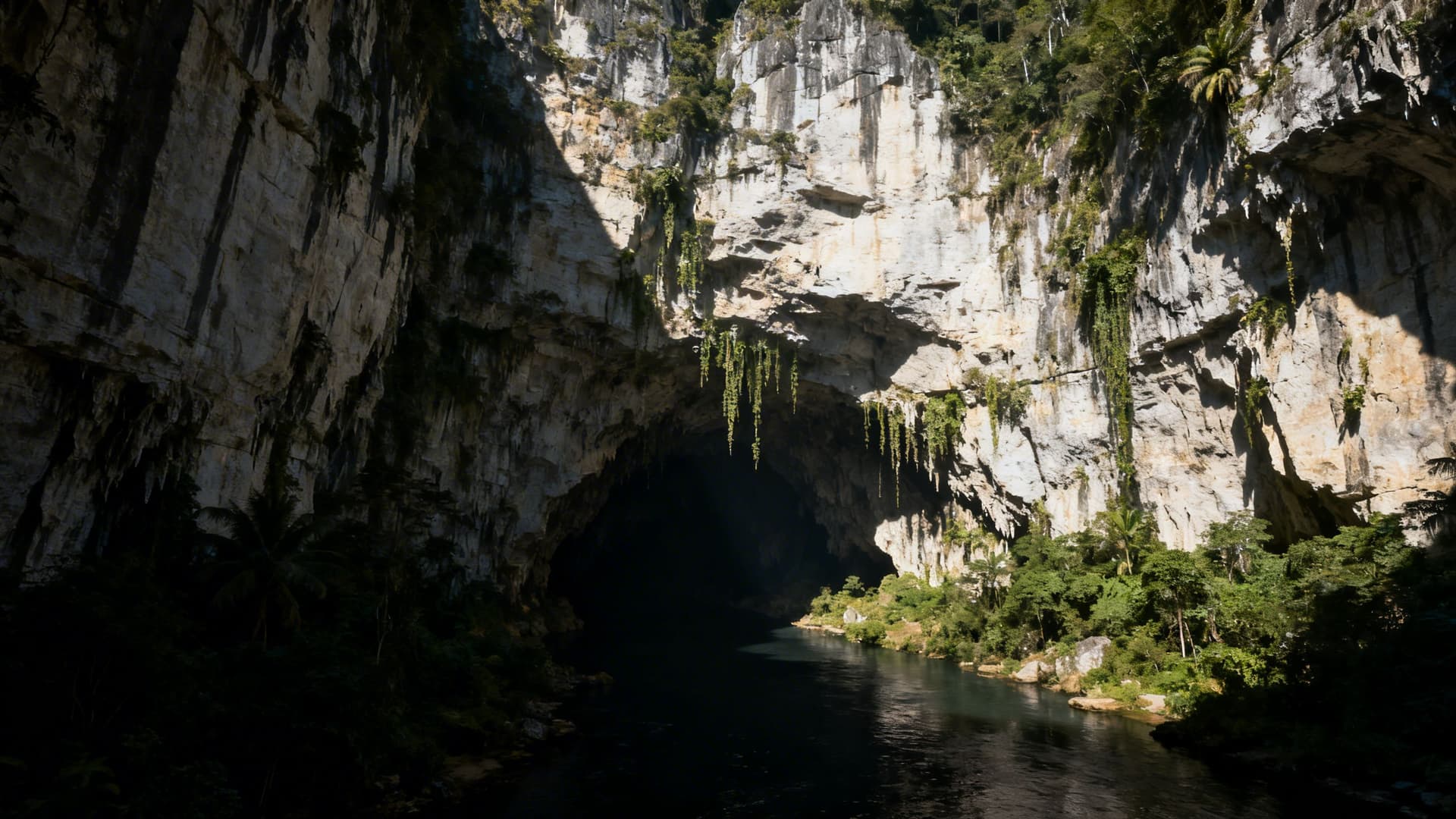
The northern edge of the Hidden Heartlands abuts a landscape of different geology entirely — the Fermanagh limestone plateau, which produces the most dramatic cave system in Ireland and one of the most significant in Europe. Marble Arch Caves, nineteen kilometres from Enniskillen in County Fermanagh (technically in Northern Ireland, though the Geopark they anchor crosses into Cavan), run guided underground tours from April through October. The boat section, gliding into the mountain with the ceiling dropping to inches above your head, is the most viscerally unusual experience in this part of Ireland.
The Cuilcagh Mountain walk above the caves — 7.5 kilometres to the summit plateau at 665 metres — completes the picture: underground in the morning, above the clouds in the afternoon, with the entire Hidden Heartlands landscape spread below. The UNESCO Marble Arch Caves Global Geopark designation covers 1,500 square kilometres across both counties, and the trails through the limestone karst and drumlin country reward serious walkers with a full day or more. Marble Arch Caves covers everything: the tour details, the geology, Florence Court, and why the cross-border element of this area is part of what makes it distinctive.
Getting Around: The Honest Truth About the Roads
The Hidden Heartlands is not built for the traveller in a hurry. This is a structural fact, not a complaint.
The N and R roads between county towns are manageable. The secondary roads — the local roads that take you to Rathcroghan, or the Shannon Pot, or the Cavan Burren — are frequently single-track, often unpredictable, and in some cases unmarked on sat-nav systems that rely on data that has not been updated since the last time anyone thought to update it. A physical map is worth carrying. Google Maps will route you to many of the significant sites; it will also, on occasion, route you to them via a boreen that requires reversing into a farm gate.
Driving times between the main towns are shorter than they appear on a map, because everything is close together. Cavan town to Carrick-on-Shannon is 45 minutes. Carrick to Longford is 50 minutes. Longford to Athlone is 45 minutes. The cluster is compact enough to base yourself in one county and day-trip to all the others. Athlone is the best logistical base for the southern counties. Carrick-on-Shannon works for the northern cluster. Cavan town is best if the caves and Fermanagh are the priority.
One practical note on Marble Arch Caves: they are in Northern Ireland. Payment is in sterling. A contactless card avoids the currency calculation.
When to Visit Ireland's Hidden Heartlands
May, June, and September are the best months. The light is long, the roads are quiet, and the landscape is at its most legible — the summer green of June is exceptional in the drumlin country, and September brings the first low light of autumn without the leaf drop that closes the forest walks.
July and August are fine — the weather is at its most reliable, the caves are running full tours, and the outdoor amenities are all staffed. But the roads do fill, particularly around Carrick-on-Shannon (which has a year-round weekend tourism economy driven by hen and stag parties on the Shannon) and Athlone (which is a conference and sporting venue as much as a tourist destination). The quiet lanes of Leitrim and the archaeology of Roscommon remain unaffected.
October brings the narrowboats in for their last runs before winter, the woods colour, and the cave season ends in late October or early November. The Hidden Heartlands in October has a specific quality — the tourists gone, the afternoons short, the landscape turned amber — that regular visitors consider the best of the year.
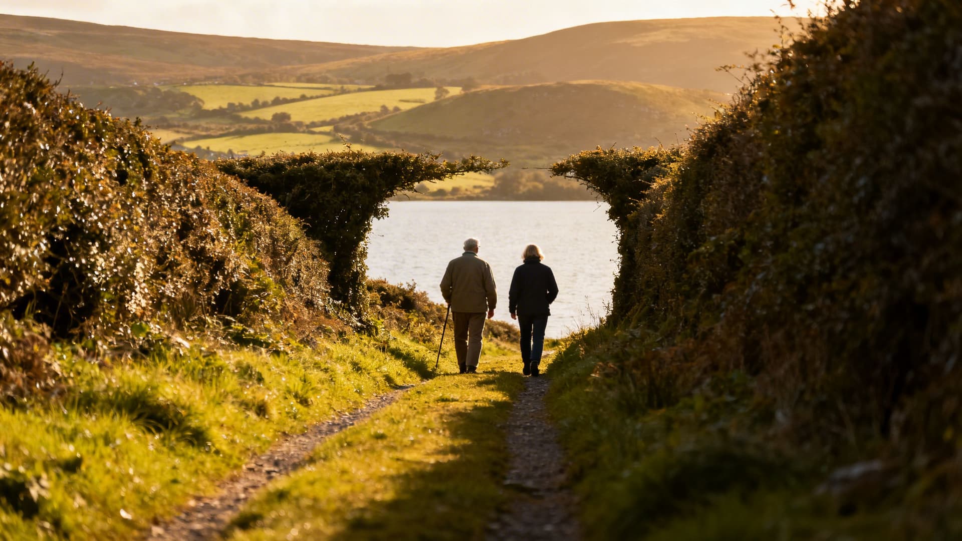
How to Explore Ireland's Hidden Heartlands with a Local Guide
The standard argument for local guides — they know where to go, they have the inside knowledge — is true here and also insufficient. In the Hidden Heartlands, a local guide is something closer to a navigator in the original sense: someone who knows the actual roads, the ones that lead somewhere, the ones that look like they lead somewhere and do not. Who knows which field the farmers will open for you and which they won't. Who can read the landscape in a way that makes the drumlins and the karst and the cave geology connect, rather than exist as a series of unrelated stops on an itinerary.
The Heartlands guides Irish Getaways works with are locals — people who grew up in the relevant counties, who know the country not from a guidebook but from a life lived in it. That is a different kind of knowledge, and it produces a different kind of visit. A day with a guide in Roscommon, where Rathcroghan, the river, and the abbey all connect into a coherent story about this county's place in Irish history, is a different experience from visiting each independently with a quick read of the interpretive board.

Find a local guide for Ireland's Hidden Heartlands through Irish Getaways. The region is large enough, and quiet enough, that a guide's knowledge is the difference between a succession of points on a map and a place you actually understand.
Frequently Asked Questions
What counties are in Ireland's Hidden Heartlands?
The core Hidden Heartlands counties are Roscommon, Leitrim, Longford, Westmeath, and Cavan. The branded trail was developed by Fáilte Ireland to promote the waterways and interior landscape of Ireland's northwest and central midlands. The Marble Arch Caves UNESCO Global Geopark, which straddles the Fermanagh-Cavan border, is closely associated with the region, though it technically falls partly in Northern Ireland.
Is Ireland's Hidden Heartlands worth visiting?
Yes — specifically if you are looking for the Ireland that isn't on the tourist trail. The region covers some of the most significant prehistoric, monastic, and natural heritage sites in Ireland, including Rathcroghan (the royal seat of Connacht in Irish mythology), Marble Arch Caves (one of Europe's finest cave systems), the Shannon Pot (the source of Ireland's longest river), and Fore Abbey (a 13th-century Benedictine priory in a remarkably intact medieval village). None of these attract the visitor numbers they deserve, which means access is easy and the experience is quiet.
How long do you need to visit Ireland's Hidden Heartlands?
A minimum of four to five days to cover the region at any depth. A long weekend based in one county — Cavan or Carrick-on-Shannon — allows day trips across the border into the Marble Arch caves and through neighbouring counties, but misses the south. Seven to ten days gives you the full picture: time to move slowly, take the unmarked roads, and let the region reveal itself rather than rushing through a checklist of attractions.
What is the best base for Ireland's Hidden Heartlands?
It depends on your priorities. Carrick-on-Shannon in Leitrim is the most tourist-ready base — good accommodation options, restaurants, and river access — and is central for Roscommon, Longford, and northern Cavan. Athlone is the best logistical base for the southern counties and has the strongest accommodation range. Cavan town works if Marble Arch Caves and the northern Cavan landscape are the priority. Some visitors prefer to move between bases rather than pick one — the distances are short enough that two nights in Carrick and two in Athlone covers the full region without backtracking.
Can you visit Ireland's Hidden Heartlands without a car?
With difficulty. The county towns (Carrick-on-Shannon, Longford, Athlone) are all on main rail lines from Dublin. Local bus services connect the towns to some outlying areas. But the significant sites — Rathcroghan, the Shannon Pot, the Cavan Burren, the Corlea Trackway, Marble Arch Caves — are not accessible by public transport. The most practical car-free approach is to base yourself in Athlone or Carrick-on-Shannon and use local taxis or a private guide for day excursions to the rural sites. A private tour guide who drives as part of the itinerary is the most efficient solution.
When are Marble Arch Caves open?
The caves run guided tours from April through late October or early November, depending on winter rainfall levels. They are never open year-round — the cave system floods in winter and tours are suspended for safety. Tours run every hour during the season. Pre-booking is strongly advised, particularly from June through August when tours sell out. Check marble-arch-caves.com for dates and booking before planning your visit.
Ireland's Hidden Heartlands is not the Ireland of postcards. It is older than that, quieter, less assembled for an external audience. The drumlins, the lake country, the cave systems, the mythology embedded in unscheduled fields — they were here before anyone thought to make a trail of them, and they are better for the lack of queue.
The detailed county guides are the place to go next: Things to Do in Cavan for the limestone north, Things to Do in Leitrim for the uplands and waterways, Things to Do in Roscommon for the mythic midlands, Things to Do in Longford for the quietly remarkable interior, Things to Do in Westmeath for the lakelands, and Marble Arch Caves for the geological borderlands to the north. To move through all of it in the company of someone who knows it — find a local guide for Ireland's Hidden Heartlands through Irish Getaways.
Table of Contents
Share this post
More from the Blog

Bog Bodies of Ireland: Where Ancient Remains Meet the Bog
Ireland's bog bodies are among the best-preserved prehistoric remains in Europe. Here's where they were found, what they reveal, and how to see them with a local guide.

Bog Oak Ireland: The Ancient Wood Preserved in Peat
Bog oak is ancient oak wood preserved in Irish peat bogs for thousands of years. Learn how it forms, where to see it, and why Irish craftspeople still value it today.

Ireland's Bogs & Peatlands: A Complete Guide to the Landscape, History and Wildlife
Ireland's bogs and peatlands shaped its culture, climate, and wildlife. Discover raised bogs, blanket bogs, fens, turf-cutting heritage, bog bodies, and where to explore with a local guide.